
Southern Patagonian Ice Field
Torrential rain and snowfall as I’ve never experienced before!
When you ask for adventure in Patagonia, you shouldn’t be surprised if you get it. Torrential rain and snowfall as I’ve never experienced before. Throughout the night I had to leave the comfort of my warm sleeping bag to dig out our tent to avoid it collapsing on itself from the weight of snow.

Getting ready
For this epic adventure we teamed up with two German climbers, Christian and Christina, who were equally excited about undertaking this challenging adventure. Even under the best of circumstances this would be an experience for life. And this turned out not to be the best of circumstances…
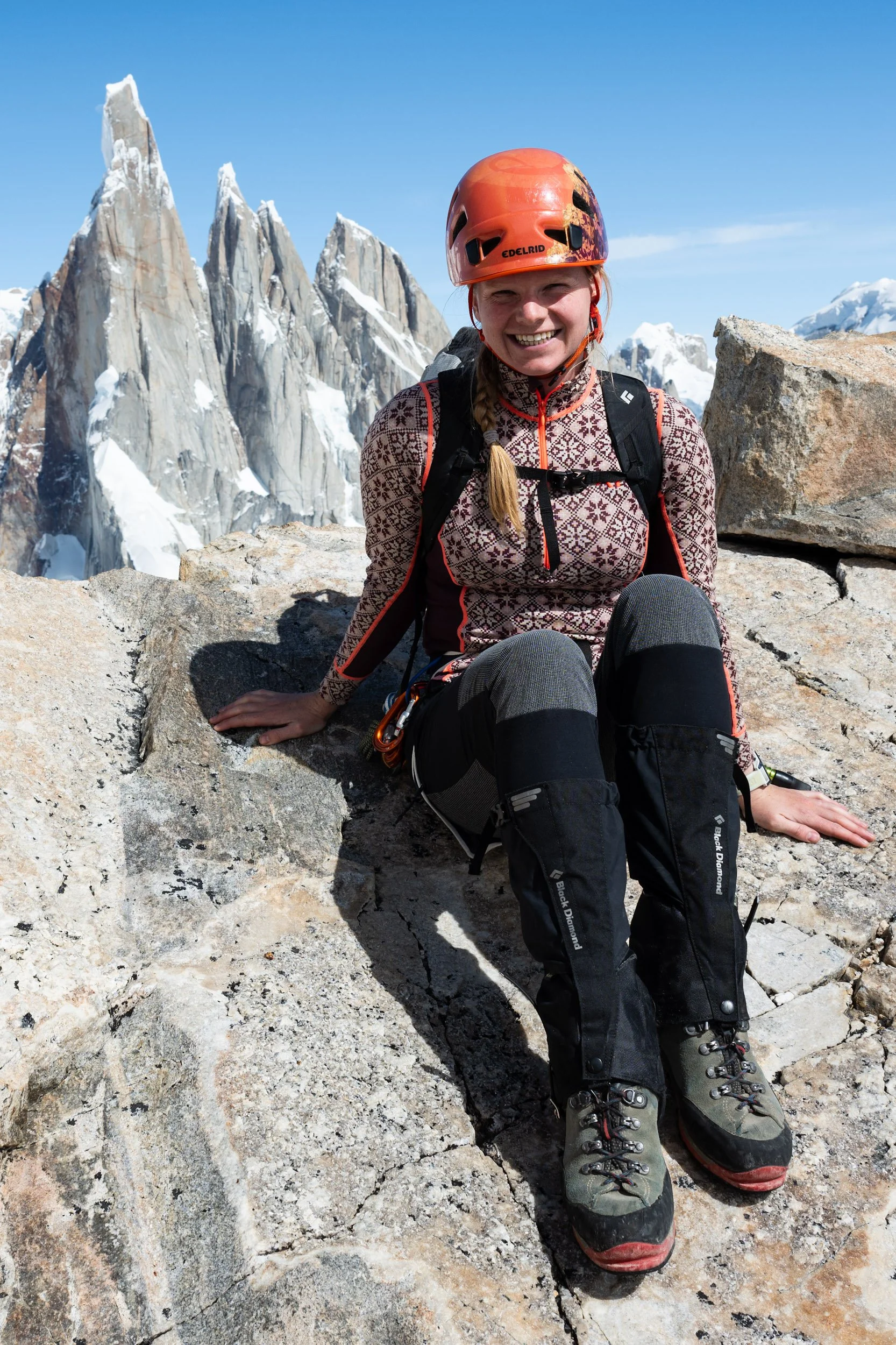
We met Christian and Christina at the El Relincho campsite in El Chaltén. They, just like us, are on a months-long trip to climb in some of the most spectacular places around the world. We shared a table in the common room one particularly busy evening and the click was instantaneous. Talking about our plans, we quickly realised that we had an interesting overlap. A traverse of the Southern Patagonian Ice Field.
Britt and I mostly climb just the two of us. It gives independence and freedom to make plans and decisions as we see fit, but for an adventure like this, we were happy to team up with other adventurous spirits. Besides being cozy it also adds additional safety being four instead of two. It’s more counterweight on the rope, if one falls into a crevasse. It’s an additional tent, if one breaks in a storm. It’s more hands, if one needs help.
Because our planned route would take us over the border from Argentina and into Chile, we needed to clear two legal hurdles before we could set off for the mountains. Just as when we climbed in Torres del Paine, we needed permission from DIFROL. This time the DIFROL-permit was even more important. Now, it would not only be a climbing permit but also our authorization to enter Chile without entering via a standard border crossing. The needed DIFROL-permit is relatively easily obtained online. Crossing over Paso Marconi puts you on the Southern Patagonian Ice Field which for DIFROL classifies as a complex expedition. The application process is therefore also somewhat more complicated than for the frequent summits but it’s still manageable.
To get exit authorisation from the Argentinians you need to report to the Argentine National Gendarmerie and get their approval. It’s a straightforward process which requires you to show up in person at their office in El Chaltén and supply them with information about you and your plans. Apart from getting the exit-permit and a stamp in our passports, we also got a lot of valuable information about the route from the border officer. He himself was clearly an experienced mountaineer and very familiar with the area. The official process took a few minutes, but we spent more than an hour talking and listening to his advice. Following his advice, we went straight to the supermarket to get some additional supplies.
Now that we had secured an entry permit to Chile and an exit permit from Argentina, it was time to get moving. Once again, the Patagonian weather had been bad for days. Luckily, the weather forecast was showing signs of relief. The forecast was not perfect, but it should be good enough. Our plan was to complete the traverse in seven days. Because of the unpredictable nature of the Patagonian weather, we decided to carry food for nine days in total. A heavy backpack but it should give us some extra flexibility. The plan was as follows:
Day 1: Hike to Laguna 14
Day 2: Climb to Refugio Eduardo García Soto
Day 3: Climb Cerro Gorra Blanca
Day 4: Rest at Refugio Eduardo García Soto
Day 5: Traverse to Circo De Los Altares
Day 6: Travere to Paso del Viento
Day 7: Hike to El Chaltén
From the forecast we knew that the weather on our fourth day would be rather lousy which is why we planned this as a rest day. Climbing Gorre Blanca is also not an easy, short day so a day’s rest after that would probably be appreciated.
Heading off
The four of us set off from El Chaltén in a tightly packed taxi with destination Rio Eléctrico. The car was packed as by professional Tetris players. When we stepped out of the taxi, the rain started pouring down. Time for rain clothes.

The first part of the route follows the same well-marked path as for Cerro Eléctrico. At the point where you turn off for Cerro Eléctrico, you continue straight. After another hour or so, you pass through the Piedra del Fraile camp site and continue onto an old riverbed. Once over the riverbed, you cross through some easy rock formations. Once through this rock you get to the shore of Lago Eléctrico. At this point we had been on the move for at least a handful of hours, and it had been pouring down the entire time. Even with good rain clothes, we were getting drenched.
The route continues along the southern shore of the lake. Here you have to cross a few smaller streams. The crossing isn’t mentioned in any of the guides so it shouldn’t be too much trouble. Or so we thought. Because of the heavy rain, the streams had turned into rushing rivers. We managed to cross the first few but got stuck dead in our tracks about halfway through the riverbed. We spent more than an hour trying to find a way to get across but there was simply no way of doing it safely. Crossing a river forces you to consider two possible scenarios. The first is falling and getting soaked. Not great but also not the end of the world. The other is falling and injuring yourself. Something as simple as a sprained knee or a broken ankle is a serious problem in a place like El Chaltén. Here, all mountain rescue is carried out by a small volunteer force with limited resources. There are no helicopters available, everything happens on foot. A very real scenario is that help is at least 24 hours away.
Not ready to give up on our adventure yet, we decided to pitch our tent close to the river and try again in the morning. We knew from the forecast that the rain should stop in the afternoon and that it should keep dry during the night. With this, we hoped that the water level would drop far enough for us to be able to cross safely.

Soaked from top to toe, we pitched our tent and started to dry our clothes. Easier said than done when it’s still pouring down outside. Luckily, just as the forecast had predicted, the rain subsided in the late afternoon, and we could lay out our clothes for drying in the sparse afternoon sun. Within a few hours most of our clothes were dry again. As always, our heavy mountain boots are the trickiest to get dry.

The next morning, we packed our tent and headed for the river, hoping it had turned back into a tranquil little stream. To our disappointment, the water level was still high. Not as high as the night before but nowhere as low as we had hoped. Early in the morning we had seen two adventurous Brits wading through the river. The first one seemed to have crossed without much difficulty, but the second one took a dive just before reaching the far side of the river. Getting soaked in icy river water early in the morning must be a refreshing experience.
We started by looking at the place where the Brits had crossed but to our eyes this didn’t look like a great idea. Even at the widest point, the river was looking fierce and from seeing the Brits cross, we knew that the river was at least thigh-deep in the middle. We decided to spread out and search for other options. Our preference would be to find a way to cross by jumping from stone to stone but wading would also be an option if we could find a suitable spot. Christian and Britt went upstream, Christina and I went downstream. It was quickly clear that downstream wasn’t an option. Cristina and I returned to the starting point. Partially fuelled by frustration we started building a stone bridge. Or at least we tried. The first few meters went surprisingly smooth but after that the power of the river was too strong. Stones the size of a football were effortlessly swept away by the rushing water. After a thorough search upstream, Christian and Britt returned without having found a route through the water. Once again, what now? In an attempt to get to the other side Christian decided to try wading through the river. The Brits had used their approach shoes to walk through the water, but we were only carrying our mountain boots so we would all have to make the crossing barefoot. Without shoes the rocks are even more slippery. After a few steps into the water, Christian turned around. No way we were attempting this crossing for now. After multiple hours of trying to find a way through, we gave up and started our retreat. Disappointed, we discussed back and forth what we should do with our time. After all, we were in the mountains and ready to go! But nothing could really get us as excited as our first plan. We decided that lunch was probably a good idea. Great decisions are rarely made when hungry and tired. We took shelter from the wind behind a rock the size of a van. Impressive that this colossal rock was pushed here by a glacier. Sitting here, we agreed that there was only one thing to do. We would wait yet another night. Hoping that the water levels would have dropped enough for us to cross in the morning.

Early the next morning, we once again made our way to the river. Honestly, our hopes were not high. At best, I was giving us a 50/50 chance of crossing successfully. At first sight it looked good. During our previous attempts we crossed multiple small streams before getting to the crux at the river. This time around, these streams had more or less dried up, immediately giving us hope that the water was low enough to cross. Christian and Christina went upstream to look for an option of crossing by jumping between some of the bigger rocks. Britt and I looked at the river and tried to assess what would be the best place to cross, if we were to wade it. After discussing our options there was only one thing to do. It was time to get into the water and test if a crossing was feasible. I put down my backpack and took off my boots and trousers. Better not make all my gear wet again.
As in any good fairytale, third time’s the charm. I stepped into the water and immediately felt the freezing water rushing around my feet. The pain is almost instant. Glacial water is incredibly cold and within seconds the nerve endings in your feet begin screaming that this is a bad idea. Moving through the water is a slow process. The water moves so fast that you can’t see the bottom and the riverbed is a mix of fine sand and incredibly slippery stones. Every step has to be placed with the utmost care. One step at the time, feeling your way through the cold river. Feeling with your toes, trying to find stable ground. As you progress, your toes begin to go numb from the cold making this progress even slower. About halfway through the river, the water level has reached well above my knees and my legs are begging for this to end. I managed to make it across. Standing on the other side, the blood rushes back through my legs, trying to reheat the skin. The result is an intense numb, prickling sensation. After a few minutes the pain from the cold water subsides. What is left is the pain from slamming your toes into stones that you hadn’t seen.
Now standing on the other side of the river, having proved that crossing is a viable option, I needed to return in order to get my clothes and equipment, and to convince the others that this was the way forward. Moving back through the river once more, the pain was excruciating. I needed to stay completely focused to avoid panic taking over. Back at the starting point, we discussed the options. I had managed to get safely across the river twice but there was one more serious thing to consider. Moving through water without our heavy backpacks is one thing, but attempting this with the backpacks is another. After deliberating for a few minutes, we agreed that this was our best and only option if we were to continue our adventure. We agreed that Christian would go first, followed by Christina and that Britt and I would finish up the crossing.

With all four safely on the other side, we could finally continue our adventure, now almost 36 hours behind schedule. Making up for all this lost time wasn't an option. The terrain is simply too harsh for that. We needed a new plan and to accept that we wouldn’t be able to achieve all the objectives we had set for ourselves. The first and easiest thing we could scrap from our planning was the attempt at climbing Cerro Gorra Blanca. For me, a significant disappointment. I knew it was the right decision, but I’d been looking forward to climbing this particular mountain since the moment we started planning our trip to South America months ago. Removing Gorra Blanca from the planning meant that we had won 24 hours in our schedule. Almost back to square one. If we would manage to make it to the mountain hut at Paso Marconi in one go, we would more or less be back on track.

Getting to the ice
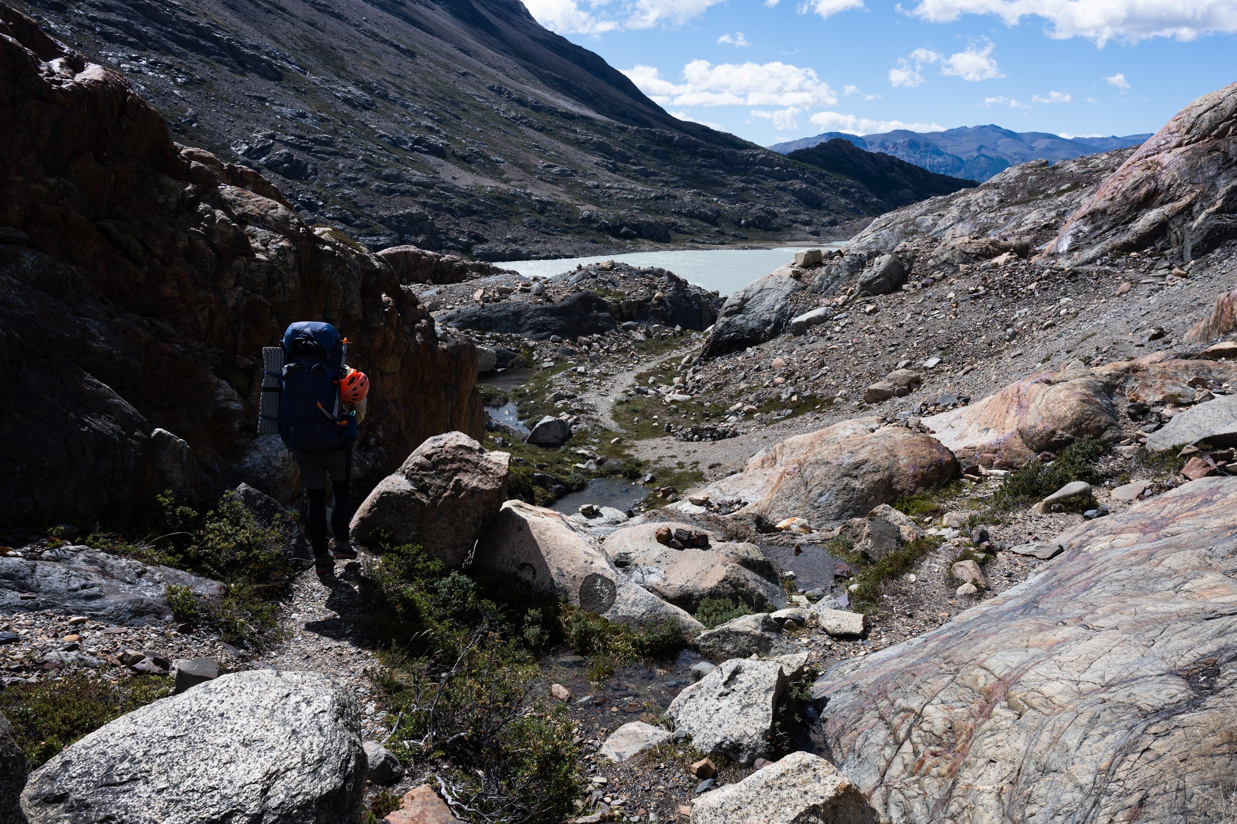
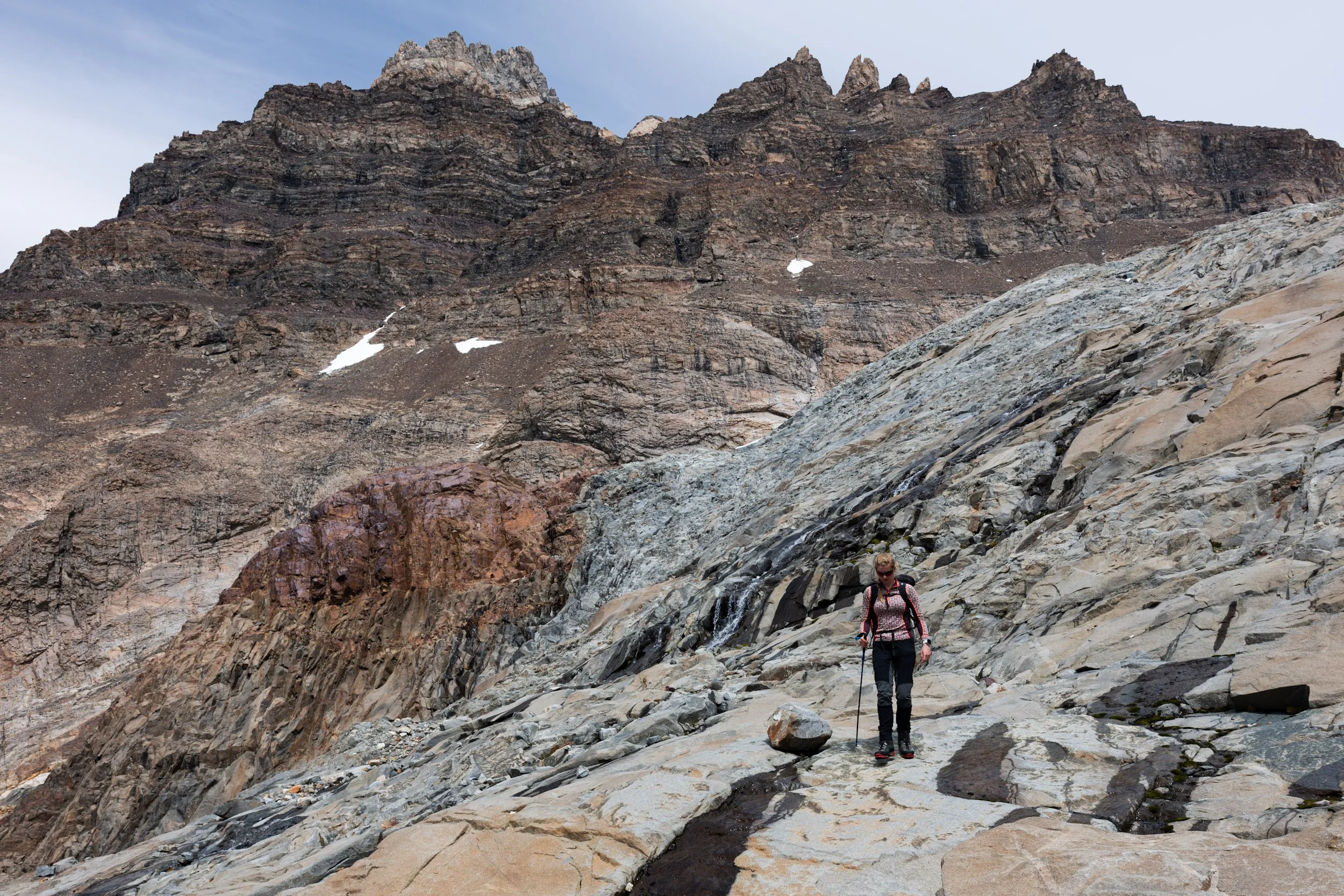
Getting to the hut in one go would be an undertaking. Between us and the hut stood 1200 meters of elevation gain spread over about 12 kilometres of horizontal distance. Doesn’t sound too bad but taking terrain and weather into consideration, it was to be a long, hard day. From the river the path continues along the south shore of Laguna Eléctrico. At the far end of the lake, the route makes its way through slappy rock formations. Over generations the rock has been polished by the movements of the glacier which once covered this entire area. With time, the surface of the rock has become beautifully smooth, and you clearly see the striations left behind in the rock. It always strikes me how unbelievably powerful ice is when it moves along as a glacier. Not only polishing the rock beneath it but also pushing along gigantic stones. An immense amount of power is hidden in a calmly looking glacier.

After another hour we made it to the first zip-line. The zip-line crosses a 20-meter-wide gorge which has been cut into the mountain by the water rushing through it. The water passes by with such an immense force that the noise makes it difficult to communicate with each other. After a short deliberation on how we should cross, we put on our climbing harnesses and prepared our backpacks for the crossing. Christina went first and once she had secured herself on the far side, I went over. With the help of a rope, we pulled our four backpacks to the other side. Once we had the backpacks secured, Britt and Christian followed suit.

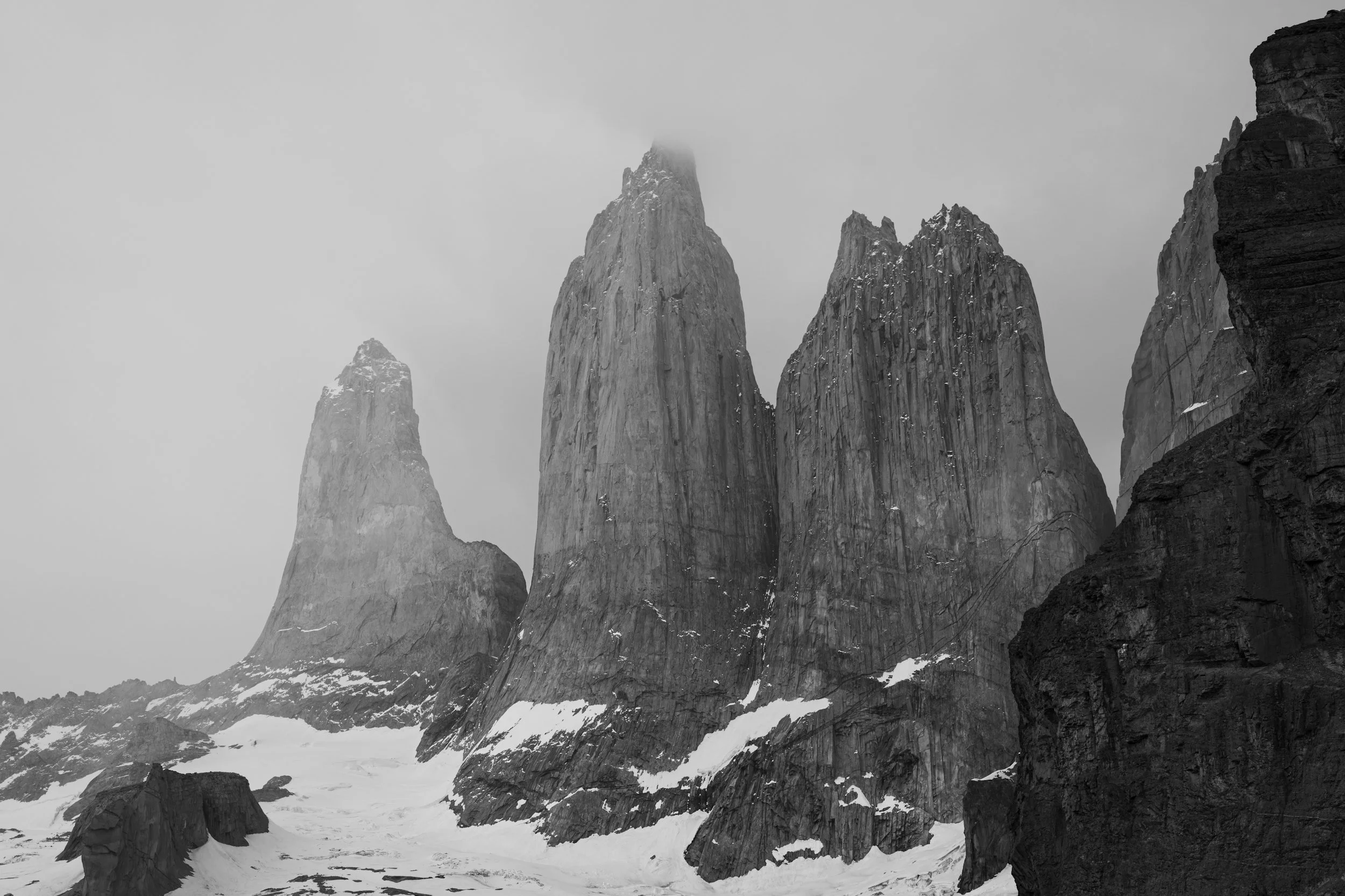
From the zip-line we moved into the gully passing by Laguna 14. Nowadays this is the preferred route towards Paso Marconi. Heading up via the Marconi Glacier is considered too dangerous because of the high risk of serac fall. The first section up through the gully towards Laguna 14 is quite straightforward. And yes, I totally agree, Laguna 14 (or Lake 14) isn’t the most original name ever. I guess naming lakes gets boring at some point. As you pass Laguna 14, a majestic glacier comes into view, hanging some 150-200 meters above the bottom of the gully. As you stand there looking up at the vertical, wet rock surrounding you, it looks like an almost insurmountable task getting up to the glacier. As so many times before, it’s about remaining calm and getting closer. As you approach the near vertical wall, a route begins to form on the left side of the gully. A narrow path cuts through the slappy rock up the mountain. In the most exposed and technically difficult place, a rope has been fixed to offer some additional protection.

Moving through the gully, it's beginning to feel like a proper alpine adventure. After working our way up the slopes of the gully, we finally made it to the edge of the hanging glacier. Here we had to make yet another important decision. Where were we to step onto the ice. Gazing at the glacier in front of us, a sea of ice filled with meter wide crevasses. There was no way around this amazing maze of ice and deep crevasses. It was all about finding the best way through it. We found a suitable spot to start our journey over the ice. Our expectation was that it would cost us an hour or two to cross the ice and get to Paso Marconi. Our aim was to reach the small hut just above Paso Marconi. The hut functions as part border post, part research station and if neither Chilean Carabineros or scientists are using it, it’s open to people crazy enough to make the journey. We were unable to get any reliable information about whether anyone was using the hut ahead of time, so we went with the hope that we could use it but also fully prepared to pitch our tent next to it.
While walking on the tongue of the glacier we were relatively well protected against strong winds, but as we made our way towards the upper parts of the glacier and headed towards Paso Marconi, the exposure to the elements dramatically increased. As we headed over the upper parts of the glacier, the winds picked up and it started snowing. Not the beautiful, calming cartoon-like snow, but the wet and soul drenching kind. Just cold enough to fall as snow, just warm enough that it turns to water instantaneously as it hits you. Together with the howling western wind straight in our faces, this made it a real challenge. Not only was it physically exhausting but navigating was also getting harder. Even with good weather and full visibility navigation on a large glacier can be challenging. Estimating distances can be tricky and with few visual reference points you need to stay focused. With poor visibility, you're in a completely different world of trouble. In a complete white-out you can’t navigate using your eyes. You have to rely on your GPS or a good old compass. Navigating with the help of a GPS makes life a lot easier. Luckily, we had multiple with us.
As we walked over the glacier the weather alternated between good and bad. In brief moments of good visibility, we enjoyed the spectacular scenery and got a glimpse of our route ahead, but for the most part, we were moving along slowly with our heads facing down, trying to protect ourselves from the high-speed slush ice bombarding us. After about an hour in these conditions even our expensive rainproof clothing and boots started to give up and let water seep through. It’s difficult to relay how bad the weather really was but to give a point of reference, it was so bad that my camera stayed in my backpack. I’m normally not too worried about my camera gear being exposed to the elements, it’s built for it, but this was too much. As a result, there’s also only very few images from this part of the adventure.
Refugio Eduardo García Soto
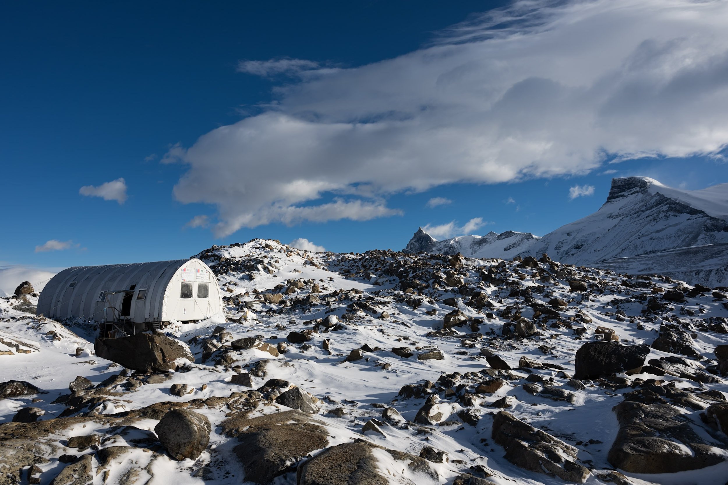
As we continued to push over the glacier, we made our way to the first part of Paso Marconi. From here we had a brief glimpse of the hut in the far distance. From this distance, all you see is the vague outline of what looks like a small structure on the rocky ridgeline. The next half an hour you keep questioning yourself whether you actually saw the hut. As we slowly approached the hut, we could begin to see the outline of a hut with two small windows facing our way. The distance to the hut was still at least 2 kilometres over the ice. Because of the lack of snow, we would have to make a big soft turn in our approach instead of approaching the hut straight on. Making the soft turn over the ice felt like a true eternity. Even though we were closer than ever, it still felt like an almost impossible task to get there. At this point it was around 19.00 and we had already been underway for almost 12 hours. Clear signs of exhaustion were setting in. Approaching the hut, we were deeply hoping to find an empty hut so that we could just roll out our sleeping bags and get some rest. Not all the hassle of putting up the tent and making the beds. But little did we know, we found something much better. We found a hut full of caring Carabineros.

As we got close to the hut, I saw that the outer door to the hut was open. Initially disappointed, we approached the hut, and I walked the few steps up the metal staircase. The crampons under my boots against the metal steps made noise enough that a knock on the inner door was obsolete. Before I reached the door, the door flung open, and a head peered out. He took a quick glance and turned his head back into the hut and yelled “Four! They’re four”. Before I knew it, I had been pulled into the hut and the Carabineros started stripping us of all our climbing gear. They clearly knew that someone arriving at this time of day after a full day exposed to the elements, could use a helping hand.
In the time it took us to get our climbing gear and soaking wet outerwear off, the carabineros had placed four chairs on a row for us. Within seconds of sitting down, freshly brewed coffee and cookies were placed in front of us. Never in my life has a cup of French press been this delicious. After the first few sips of coffee, it was time for a bit of official business. It is after all a border post. We presented our passports together with the DIFROL-permit and after a few minutes of administration, we had officially entered Chile. After another cup of coffee, it was time to leave the comfort of the hut and head outside again. With the carabineros staying in the hut, we had to pitch our tent outside.
We put on all of our warm clothes and headed for a spot not far from the hut. The carabineros had advised us to pitch our tent there. Nicely flat and relatively well protected against the relentless western wind. Pitching the tent between the rocks went surprisingly smooth. As soon as the tent was standing, Britt started organising the inside and I started working on extending the small stonewall already built around the camp spot. We knew we were fighting against the clock. A weather front carrying at least 40 cm of snow was heading our way fast.
After having pitched the tent and prepared it as well as we could, we headed back into the hut. Even though we weren’t allowed to sleep in the hut, we were more than welcome to stay in the hut during the day and use the kitchen to cook our food. Unfortunately for Britt and I, Spanish is not really our strongest suit. A slight disadvantage when travelling in this part of the world. Lucky for us, Christina’s Spanish is rather good. A big plus when trying to make new friends. With the help of our limited Spanish, a few English words here and there, and the excellent high mountain translation services offered by Christina, the conversation was flowing. We were telling tales of our many adventures and the carabineros were telling about life as a carabinero in what must be one of the most remote and inaccessible border posts in the world. As a team of five carabineros, they man the border post during the summer months. Outside the summer months the weather is simply too bad for most climbers to even contemplate going up here. The Carabineros stay in the hut for 15 days after which they rotate out and another team takes over for the following 15 days. After 15 days off, they rotate back to the hut. The cycle continues like this all summer. 15 days on, 15 days off.
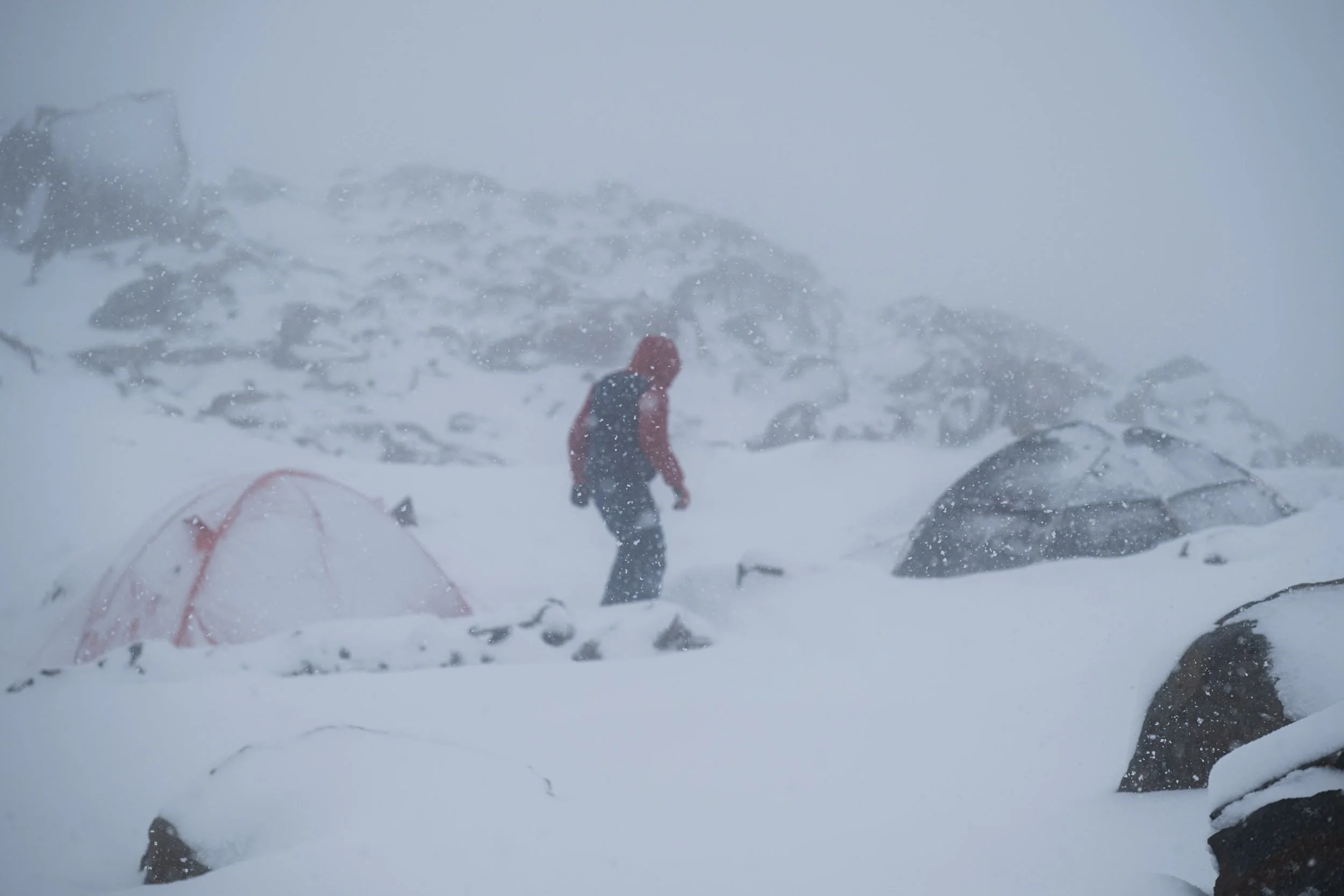
After a cozy and very interesting evening in the comfort of the hut, we ventured into the cold night. There was no way around it; to get to the warmth of our sleeping bags, we had to make our way through what was turning into a snowstorm. It had only been snowing for an hour or two by the time we left the hut, but both of our tents were already covered in a thick blanket of snow. To get into our tents we first had to dig them out of 20 cm dense, heavy snow. The kind of snow perfectly suited for an epic snowball fight.
During the night, the snow kept hammering down and the tent started showing signs of bending under the weight. Next to that, the condensation inside the tent was getting out of control. Because of the snow, all the ventilation channels were covered. With no fresh air flowing in, and no moist air escaping, the condensation was starting to create its own rainforest-like microclimate inside the tent. As a result, I had to leave the comfort of my warm sleeping bag every few hours to dig out the tent.

The next morning, we woke up in a true winter wonderland. Everything around us was covered in at least 40 centimetres of fresh snow. It was still snowing but much less intense than during the night. In our planning we had set the day aside as a rest day. The night's intense snowfall had been forecasted and based on that we knew that it would be almost impossible to continue that day. This much fresh snow covers all the crevasses so that they are impossible to see, but without time for the snow to consolidate, it has almost zero stability. It’s not substantially different from walking on a cloud. This means that you’re destined to fall through the snow and into the crevasse every time you come across one. Our hope was that with one day of relatively high temperatures and one good cold night the snow should have consolidated enough for us to move across the glacier without falling into every single crevasse on our way.

We spent the day hanging out with the carabineros in the hut. With the snow still falling outside there wasn’t much more to do outside than take a few photos and then quickly return to the comfort of the hut. The hut isn’t actively heated but the fact that you’re protected against the elements makes a big difference. There was no thermometer, but my guess would be that the temperature in the hut was just around zero degrees Celsius. The inside of the outer walls was covered with a thin layer of ice, while water left on the table didn’t freeze over. Most of the day was spent waiting. Passing time by playing games, watching movies, telling stories, making food and melting snow. Outside the hut there is an intricate system of pipes that allows for the collection of melted water from higher up the mountain. This of course only works when the temperature is above zero. When the temperature drops below freezing, the only option left is to collect and melt snow in order to get water. It should not be underestimated how much time it takes to melt snow enough for the needs of 9 people. It’s an almost continuous task.
The second night was substantially colder than the first. There had been no new snowfall, but the wind had turned a bit causing the air to flow around the stonewall and in under the side of the tent. This meant that we had a steady stream of sub-zero degrees air flowing through our tent and over our sleeping bags. Luckily, we have quality sleeping bags made exactly for these conditions. As an added bonus, the airflow meant that we didn’t have any issues with condensation inside the tent. A very pleasant change from the night before. Walking up and dressing was a more chilling experience. My boots, which had still not dried since getting soaked while crossing the glacier to the hut, had frozen solid. Knocking on the side of them returned a hollow sound. It sounded like you had taken them straight out of the freezer. An important lesson not to leave semi wet shoes in the outer tent. Luckily, I had loosened the lazes the evening before making it possible for me to squeeze my feet into them. The only way to defrost them was to wear them. Not the most pleasant way to start the morning.

Back to safety
After breakfast and an extra cup of coffee it was once again time to make a decision. With the help of the carabineros’ Starlink, we had been able to follow the weather forecast closely over the past 24 hours. The disappointing reality was that the forecast kept getting worse every time it updated. Our weather window was shortening, and our options were getting fewer. After having evaluated our options carefully we agreed that there was only one right decision for us. Looking at the forecast, we would have a window of about 12 hours with what looked like reasonably stable weather starting now. This would allow us to pack up our tents and get off the glacier before more bad weather was coming our way.

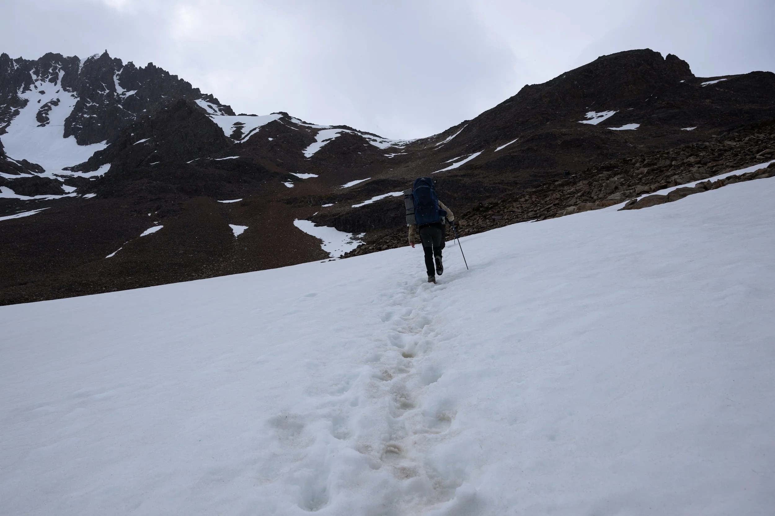
With all of our equipment packed up, we said goodbye to the carabineros and started on our way down the mountain. Setting off from the hut, I walked in front. As soon as we touched the snow it was clear that the snow covering the crevasses was as fluffy and unstable as we had feared. There was no way this snow would hold the weight of any of us. Walking in front in these conditions is a mentally draining task. At every moment there is a risk that you fall through the snow and end up in a crevasse. Best case you’re just dangling from the rope, worst case you injure yourself. Walking over the glacier I tried probing the snow with my hiking pole. Wherever there was no resistance, there was probably nothing more than a few centimetres of fluffy snow standing between me and a crevasse. Even though you don’t fall very far when you’re in a rope team of 4, there is still a real risk of injuring yourself. A twisted knee or a crampon stamped into your own leg is a less-than-optimal situation. As we walked, I fell through more than a handful of smaller crevasses. Nothing more than a leg or two swinging in free air. We knew of the risk of falling so we kept the rope tight to minimise the length of a potential fall. Tripping as I fell into a small crevasse, my razor-sharp crampon cut through my gaiters, my rain trousers and my alpine pants, just to let the tip of my crampon gently scratch the side of my leg. Close call, very close call. After having fallen through half a dozen times more, Christian and I changed places. He took the lead, and I could take a breather further back in the group.

The progress was slow because of the many crevasses which meant that we often had to backtrack our steps to find a way around a particularly tricky place. As we slowly worked our way over the glacier, the weather turned for the worse. The wind picked up and it started snowing again. It varied between lite snow with relatively good visibility to almost complete whiteout. In moments of good visibility, I thought I saw a tiny line of black specks moving our way in the far distance. At first, I rode it off as a visual trick or optical illusion. There was no way that people were moving into the mountains with this weather. Or so I thought. As time passed the tiny specks turned bigger and bigger until they turned into four people on a rope. As is good form when you come across someone in a place like this, we linked up with them to make sure that everything was okay. I’m not sure what weather forecast they had been reading to convince themselves that this was the right decision, but they were determined to continue. We shared what we knew about the route and wished them good luck.

As we approached the final stretch of the glacier, the viability was borderline horrendous. We didn’t have more than a few meters of visibility. Just as choosing where to step on to the glacier, choosing where to step off can be of great importance. Not only can the edge of the glacier be fragile and prone to collapse but choosing the wrong place can put you at a dead end. Especially with the wet, slappy rock at the edge of the glacier. With all the new snow, the glacier wasn’t at all looking like it did just two days ago. The visual cues that we had used to navigate on the way up were buried under the snow or changed so much that we couldn’t recognise them. With the help of our GPS watches we were able to backtrack our route to the area where we had stepped onto the glacier. Even with the GPS it was still a challenge to find our way down. We knew from the way up that the edge of the glacier was filled with enormous crevasses. Crevasses large enough to swallow a car. On our way up we had on multiple occasions passed between two large crevasses on a narrow piece of ice. In good conditions not really something to think deeply about but with the challenging conditions we had, it was tricky to find places stable enough to carry us over. Even though the GPS can give us a pretty accurate picture of our ascent route, it’s often not accurate enough to get us safely across a crevasse. The difference between crossing safely and falling through is sometimes less than a few centimetres.

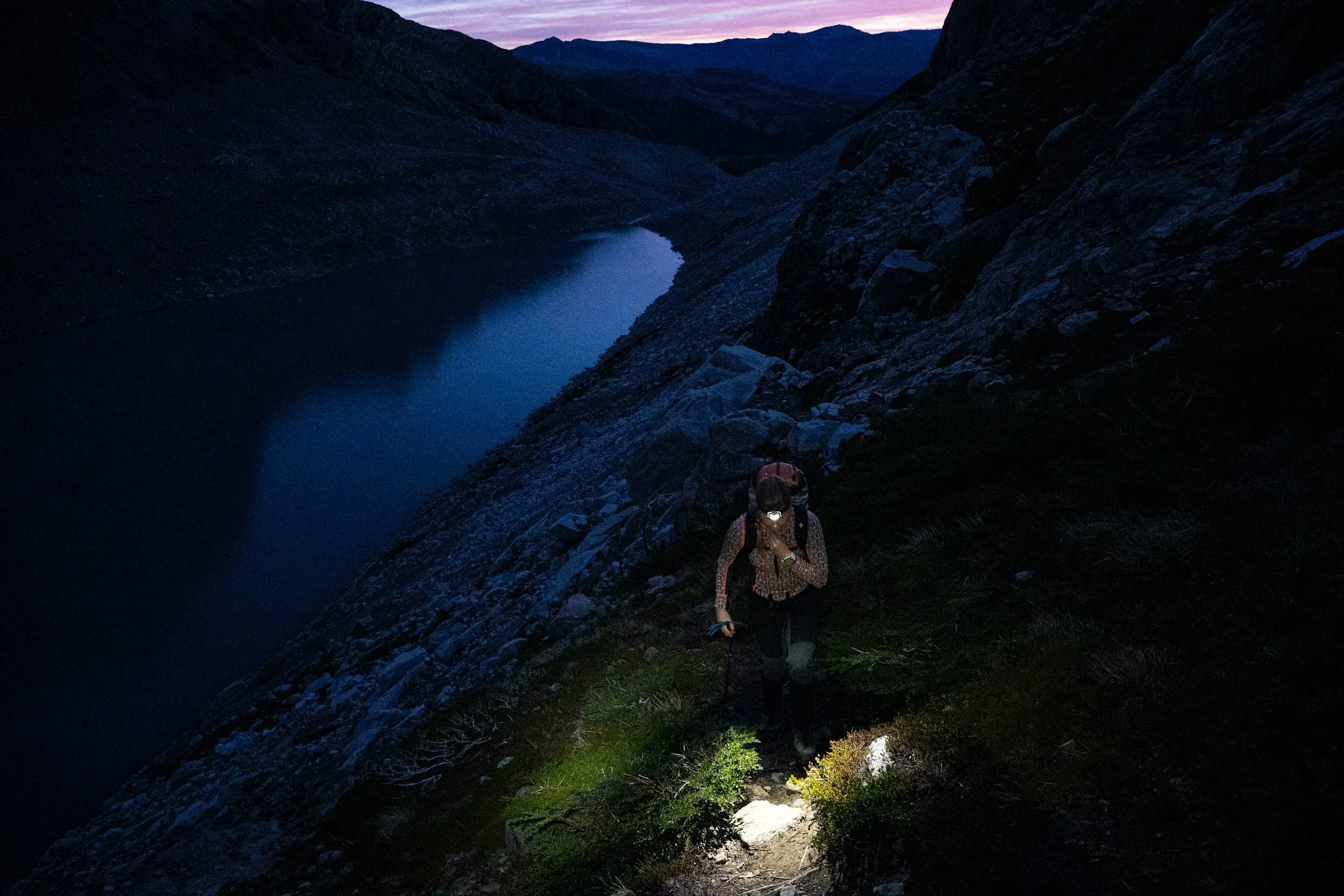
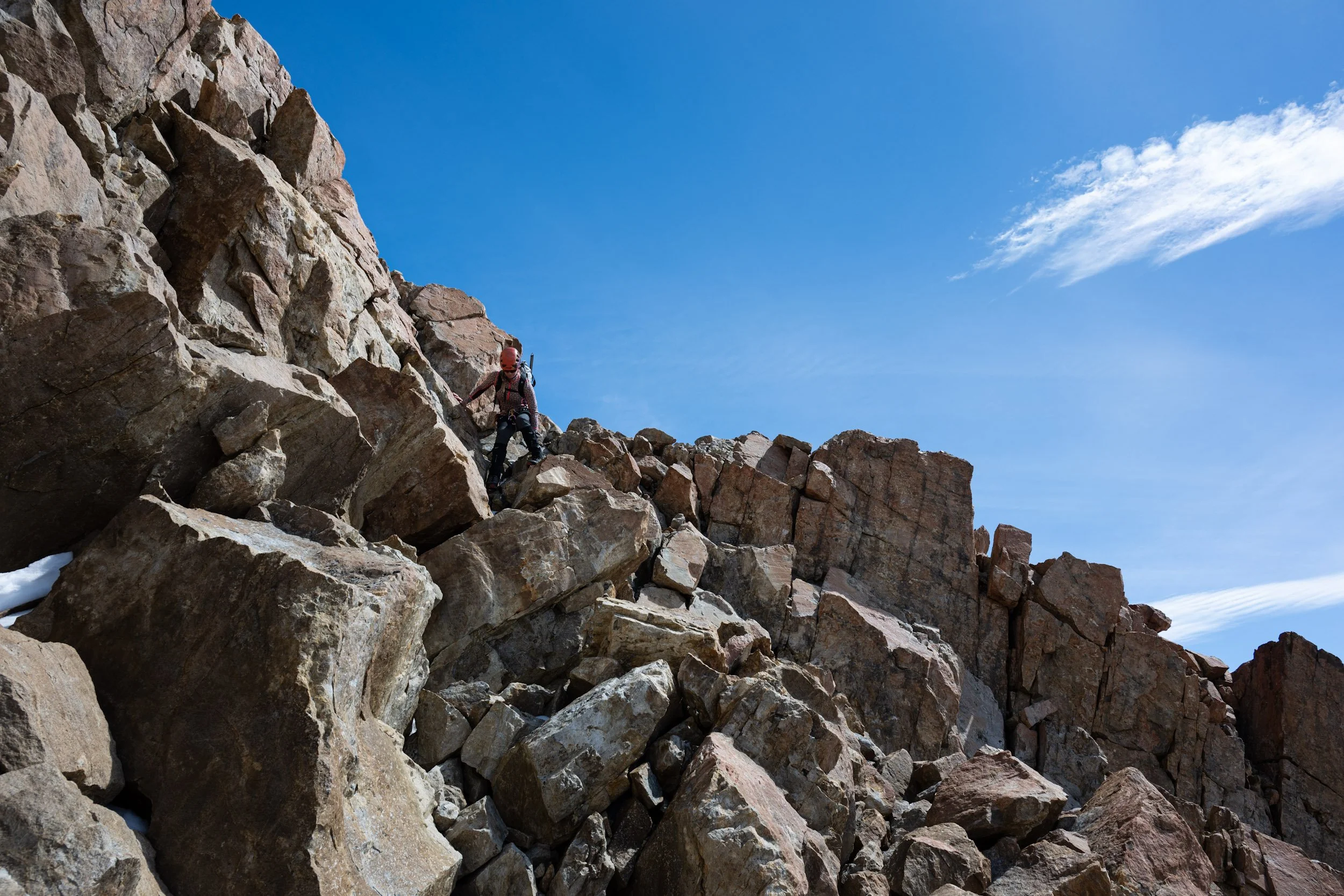
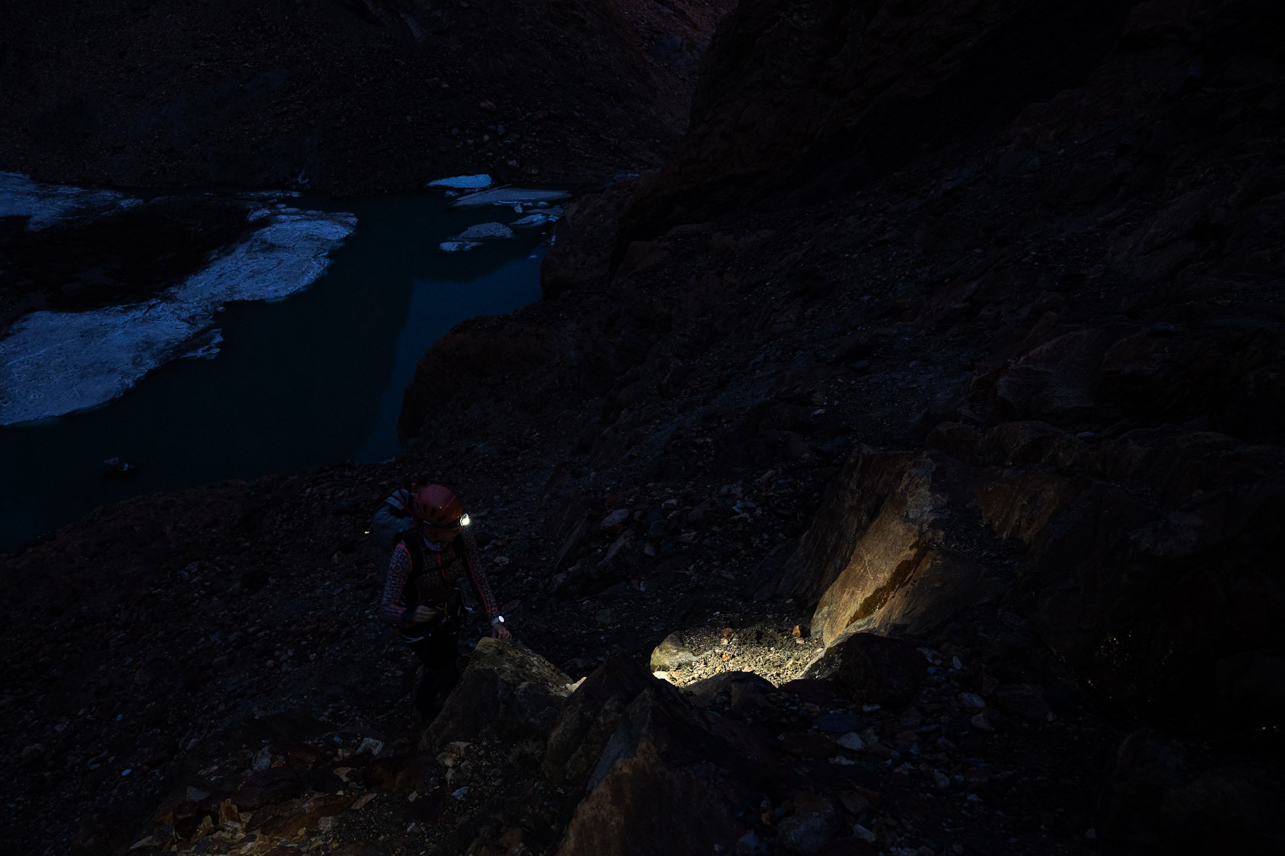
After what felt like an eternity, we finally made contact with the rock. The rocky landscape had also transformed completely. It was almost unrecognisable. What was once a small puddle had turned into a lake the size of a basketball court. Going up our route took us between the then puddle and the rock face. Passing that was out of the question now unless you fancied an afternoon swim. We needed to find another way. Finding our way down through the rock took its time but we made steady progress. In a few places we whipped out the rope to abseil particularly tricky parts. Having made our way down to around Lagua 14, we decided it was time to call it a day. After a bit of searching, we found a spot between some rocks that was just large enough to hold both of our tents. It was a bit of a tight squeeze and moving around the tents felt more like an obstacle course than a campsite.

Early the next morning we started our final descent back to the trailhead. With the most difficult parts behind us, we were making good progress. On the way down we still had two small challenges to overcome. The first one was the zip-line. This time around we crossed it in no time. With a few good lessons from the first crossing, this crossing was like a choreographed dance. The second one was the river crossing which had cost us so much valuable time on the way up. We approached the river with quite some anxiety, fearing that the last few days of bad weather would have turned the river back into a roaring monster. To our delight, and honestly our surprise, the river was lower than at any other point. This time we could skip between a handful of rocks with our shoes on and made the crossing in less than a minute. We made it back to the trailhead in the late afternoon. Christina flexed her Spanish skills one more time and secured us a ride back to El Chaltén in the back of a Pickup Truck. It felt like the perfect way to end this incredible adventure.

Back in El Chaltén it was with some vindication that we caught up with all the other climbers over the next few days. Everyone had been ambushed by how bad the weather had turned out to be. There were stories of broken tents and wind gusts strong enough to pull climbers off the walls. Everyone had been forced to abandon their plans and return to safety, not just us. One of the most important lessons that I take away from this adventure is how bad the weather in Patagonia can really get and how fast it can change. Intellectually I knew that the weather could be bad and that the change can be extremely rapid, but feeling the effects on your own body is an important lesson.

A shout-out to Christian and Christina for finishing the full traverse about a week later. The weather had stabilised greatly, and they had what looked like the most beautiful experience imaginable.


As a final remark, a heartfelt thank you to Alonso, Raul, Pedro, Sebastian and Braulio for welcoming us and taking such good care of us. You embody your motto Aunque Inmensa sea la soledad, mas grande es el amor a la Patria (Although loneliness is immense, love for the homeland is greater). You opened your small mountain home to us and offered us help when we needed it the most. Without your help, it would have been a very difficult experience. You should be proud of how you represented yourself, the Carabineros and the immense country of Chile. Thank you!

Cerro Mojón Rojo - The perfect conditions
An incredible day on Mojón Rojo!
After 10 days of rain and fierce winds, the forecast was finally showing signs of relief. A short weather window with no rain and minimal wind was on the horizon. Like a swarm of busy bees, climbers from all corners of El Chaltén emerged, flooding the trails into the mountains. Everyone who had seen the forecast was determined to make the most of it. Our plan was to attempt two peaks: Cerro Mojón Rojo and Cerro Madsen.
From El Chaltén we hiked to the moraine just below Laguna Sucia. This would be our starting point for next day’s summit attempt. We know from two American climbers, who had climbed Mojón Rojo the week before, that this would be a good spot to pitch our tent. When deciding where to pitch your tent, there is a trade off between how far you want to carry your heavy backpack and how short you want to make the ascent day. Making the ascent day short increases your chances of success but it comes at the cost of carrying your 25+ kilo backpack further up the mountain.

At 03.30, the mountain was glittering with headlamps. Lights swinging from left to right illuminating the path in front of the climbers. It’s a magnificent sight. Seeing other teams already high on the mountain, I was struck by a moment of doubt. Were we starting too late? Were we being overly ambitious or even unrealistic? Our plan was to get up at 03.30 and leave at 04.30. By the looks of it, these teams had been on the move for multiple hours already. Additionally many of them had started from a higher camp than us. After thinking through our plan once more, I agreed with myself that our plan was solid. Now we just needed to execute on it.
We left the tent and started making our way along the southern shore of Laguna Sucia. As you make your way through the moraine, the path turns left and begins making its way up the mountain. It’s a typical climbers path. Not officially marked but the path is used frequently enough that it’s easy to follow.
Two hours later, we reached the Swiss Bivy. A massive boulder the size of a truck, forming a cave large enough to sleep 10-12 people, depending on how cozy you want to make it. A dozen tents were pitched around the bivy. We refilled our water bottles and continued on our way. As we progressed, the path went from being mostly gravel and dirt to actual rock. No actual climbing but a bit of scrambling was required. An hour later, we made it to the end of the first rock section. The sun had now risen above the surrounding mountains, beautifully illuminating the landscape in front of us.

From the edge of the rock, we had a short, relatively flat piece of snow-covered glacier to cross. No more than a few hundred meters. We roped up and prepared for the glacier crossing. Both to the left and right of our path there were multiple large crevasses visible. A crevasse emerges when the tension in the ice gets too high, forcing it to break open. This mostly happens when the underlying rock is concave or the glacier is turning. Our path across the glacier followed a gentle, rather constant incline making the risk of significant crevasses smaller.

Stepping onto the glacier, we could enjoy the distinct crisp sound of our crampons biting into the firm top-layer of snow and we immediately felt the ease with which we could walk. It had been a night with beautifully clear skies, resulting in subzero temperatures on the glacier. A stark contrast to the conditions on Cerro Electrico. These were truly perfect conditions. We crossed the snow-covered glacier with ease, only stopping a few times to take in the view and make a few pictures.

Safely on the other side, we stowed away our glacier equipment. From here it should be a fun scramble to the top. The first part of the scramble crosses a section of relatively exposed and poor quality rock. Nothing too difficult but it takes time to navigate safely. Once on the ridge, the rock consists of mostly medium sized boulders which makes for a fast traverse of the ridge. Before making it to the summit, the route turns right around the summit plateau. Here, the route makes its way through one of two gully’s. Either one will get you to the top and whichever one you choose is a matter of preference. The gully is somewhat more technical but it never gets above UIAA Grade-III. Once at the summit plateau, you’re rewarded with a spectacular view of the surrounding mountains.

Sitting on the summit plateau, we took our time to enjoy the view and refuel ourselves with an excellent selection of cookies and nuts. To our pleasant surprise, it was completely windstill even on the summit and with the shining sun, we were in no hurry to start our descent.

We shared our moment on the summit with an American couple who had climbed up the same route as us. In total, I think there were 10-12 teams on Mojón Rojo that day. After the Americans had started their descent we waited for about ten minutes before starting ours. There are a lot of loose rocks on the route, making the risk of kicking something loose and causing a rock fall rather large. The best way to minimise the risk of rocks hitting anyone below, is not to climb right on top of each other.
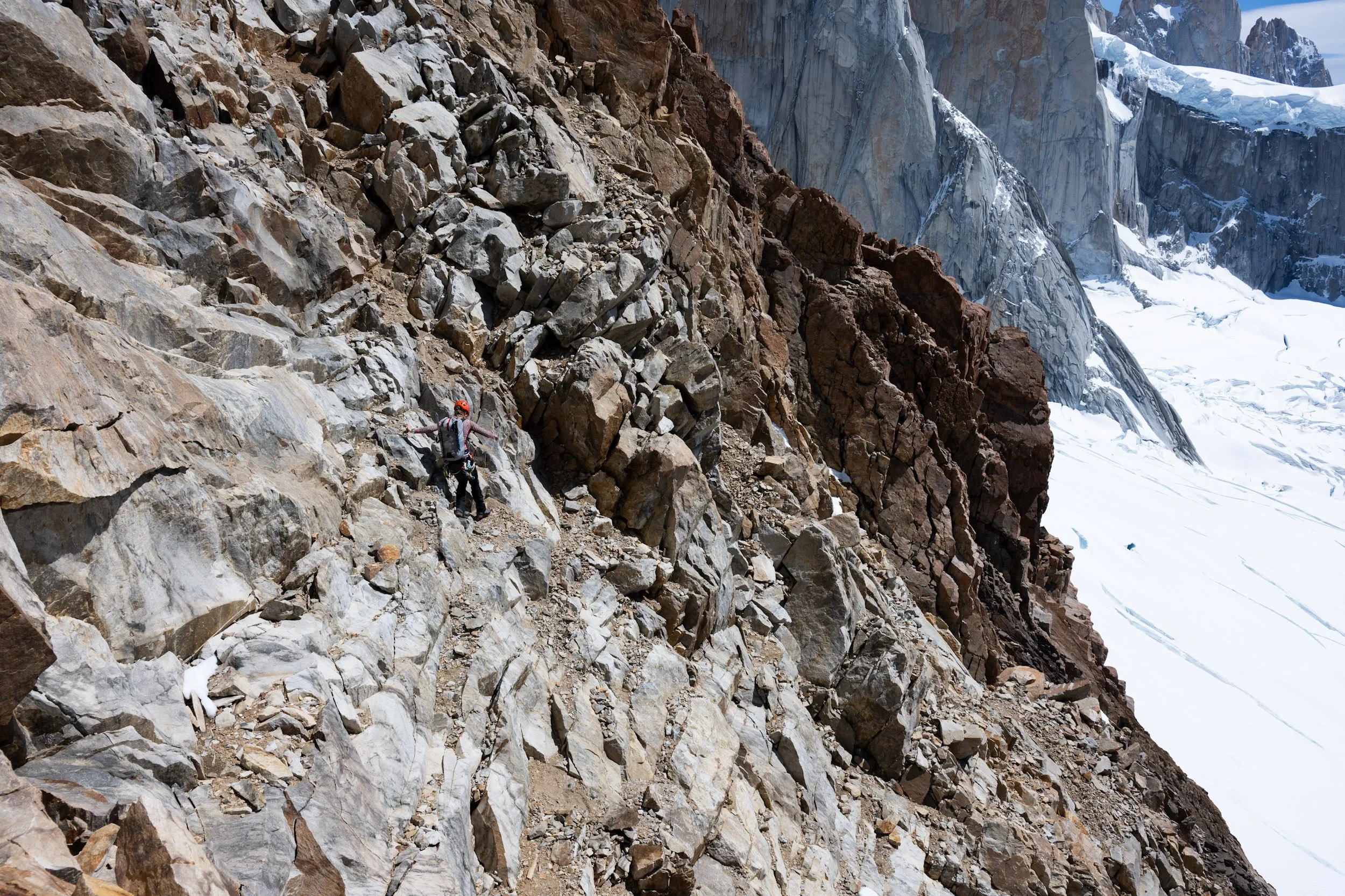
Making our way down required full focus. When moving downwards your forward momentum makes it more difficult to stop and it increases the energy with which you hit the ground. This increases the risk of a piece of rock loosening under your feet. The steeper it gets, the slower you need to go. In a few places we had to down climb short sections of rock because there was no obvious way to walk it down. Down climbing is always more tricky than climbing up. When down climbing it can be a challenge to see where your hands and feet should go and it can be difficult to make good contact with the rock.

We made our way down the mountain in good time and without any issues. Heading down we decided to extend our route over the glacier. With the snow and ice in this good condition, we could easily continue over the glacier further down. On our way up we climbed via a rock formation which we now bypassed on the right.
Once off the glacier, it was just a matter of cruising down the mountain until we got back to our tent. That was at least the expectation. But then, to ensure a memorable day, Britt took a dive into the icy river no more than 300 meters before our camp. Just before camp there is a small river you have to cross by jumping 4-5 washing machine sized stones. Together they form a path through the water. Getting from stone to stone requires a light jump and as Britt pushed off from one and landed on the next, her foot slipped, resulting in an unexpected cold plunge.
I had crossed the river already and was happily on my way down the path on the other side when I heard a yell and a large splash. Luckily a hiker was waiting at the river to cross after Britt. He quickly gave her a hand, making sure that she got out of the water after no more than a few seconds. In the fall Britt lost both her trekking pole and sunglasses. Standing on the side of the river, I saw the trekking pole making its way down the river at full speed. I quickly dropped my backpack and ran down the river all that I could. A bit further down, the river is somewhat wider causing the water to flow slower. Jumping from stone to stone I got to the middle of the river, hoping that the trekking pole would pass by within arms reach. Luckily, the pole made its way down the river right next to the stone I was standing on. Sometimes you get lucky. I recovered the trekking pole but even after a long search the sunglasses were nowhere to be found. Annoying but a small price to pay. Back at the tent Britt rushed out of her cold wet clothes and jumped into her sleeping bag. Glacial rivers are incredibly cold and combined with the low air temperature, hypothermia is a real concern which needs to be mitigated fast. After a few minutes in the sleeping bag Britt had regained her normal body temperature. We spent the rest of the day drying Britt’s clothes, relaxing in the sun and enjoying the magnificent view from our camp. As darkness fell, we once again saw the glittering lights of climbers finishing off the day’s climb.

The following day we spent in our tent, mostly eating and listening to audiobooks. We knew from the weather forecast that it would be a rainy day so we had anticipated staying put for the day. You can really make some good progress on your audiobook, if you have an entire day to listen. I must admit, after half a dozen hours of listening, the story starts to blur a bit…

On the fourth and final day of this small adventure we planned to climb Cerro Madsen, a smaller peak lying in front of Fitz Roy. The view from the summit should be spectacular. According to online resources, it should be an easy and straightforward hike with a short semi-technical section just before the summit. The first 90 % of the route was indeed a straightforward hike. The last 10 % forced us to reconsider. The route turned out to be significantly more exposed than what we had anticipated. Not highly technical but made up of poor rock with a large drop of. After having attempted a few different options, including traversing to the other ridge, we decided it was time to turn around. We could probably have finished it but the honest answer is that we were too tired and not at all mentally prepared for the difficulty of the climb. We had mistakenly prepared ourselves for a nonchalant hike to the top. In those cases, turning around is never a mistake.


As we headed out of the park and back to El Chaltén, we looked back at four days of great adventure. For us, climbing Mojón Rojo was a shining highlight. A beautiful day with perfect conditions.

Cerro Electrico
To the summit of Cerro Electrico!
We made it! Summit!

After being on the road for almost two months, we finally made our way to El Chaltén, Argentina. We have been looking tremendously forward to being here. It’s a true climber’s paradise. Here’s everything from grade IV sports climbing to some of the most challenging alpine climbing routes in the world and everything in between. We’re mostly aiming for some of those in between. Cerro Electrico is one of them.
The trailhead is located about 15 kilometers north of El Chaltén along a surprisingly busy gravel road. As life in El Chaltén is expensive enough to begin with, we decided to see if we could hitch a ride out of town towards the trailhead. At the edge of town, we found a suitable spot where we could try our luck. After less than 15 minutes, we managed to get a ride in the back of a silver pickup truck. There’s nothing quite like hitchhiking in the back of a pickup truck. The wind rushing through your hair and the dust covering you by the second. This is how adventure begins!

After about 40 minutes of bumping up and down in the back of the pickup, we made it to the trailhead. From here, we started our approach on foot towards Cerro Electrico. The first part of the trail follows a good and well-marked path, which is shared with multiple day hikes. After about an hour, the main path turns right, and a narrow climber’s trail continues straight. You have to know what you’re looking for, or you’ll likely miss it. The path, just wide enough for a mountain boot, winds its way cozily through the forest. As you progress through the forest, the incline gently increases until you reach the base of the gully. From here, the path begins to show its teeth. The first section through the gully is covered in low, dense bushes, making it a challenge to move forward, especially with big and broad backpacks. From time to time the path cuts through short rock sections, making it a fun and varied approach.

After about 4 hours, we made it to our planned campsite. On a plateau just under the glacier is an improvised campsite, which is used regularly by climbers. Calling it a campsite is maybe a bit of a stretch, but it’s a nice flat area which offers plenty of space and good protection from the Patagonian winds. We pitched our tent in a small clearing between low bushes and a solid stone wall. This was remarkably close to the perfect camp spot.
From articles and guide books, we knew that the route continued from the campsite towards a small glacier lake about half an hour further up the mountain. From here, you should be able to step onto the glacier and use that as your highway to the summit. After having enjoyed the afternoon sun for a bit, we decided to make our way towards the glacier lake. Our plan was to start the climb well before daybreak the next day. Navigating in the dark can be challenging, so preparing a bit by doing the first part of the route is always a good idea. That way, you help yourself to a good start in the morning.

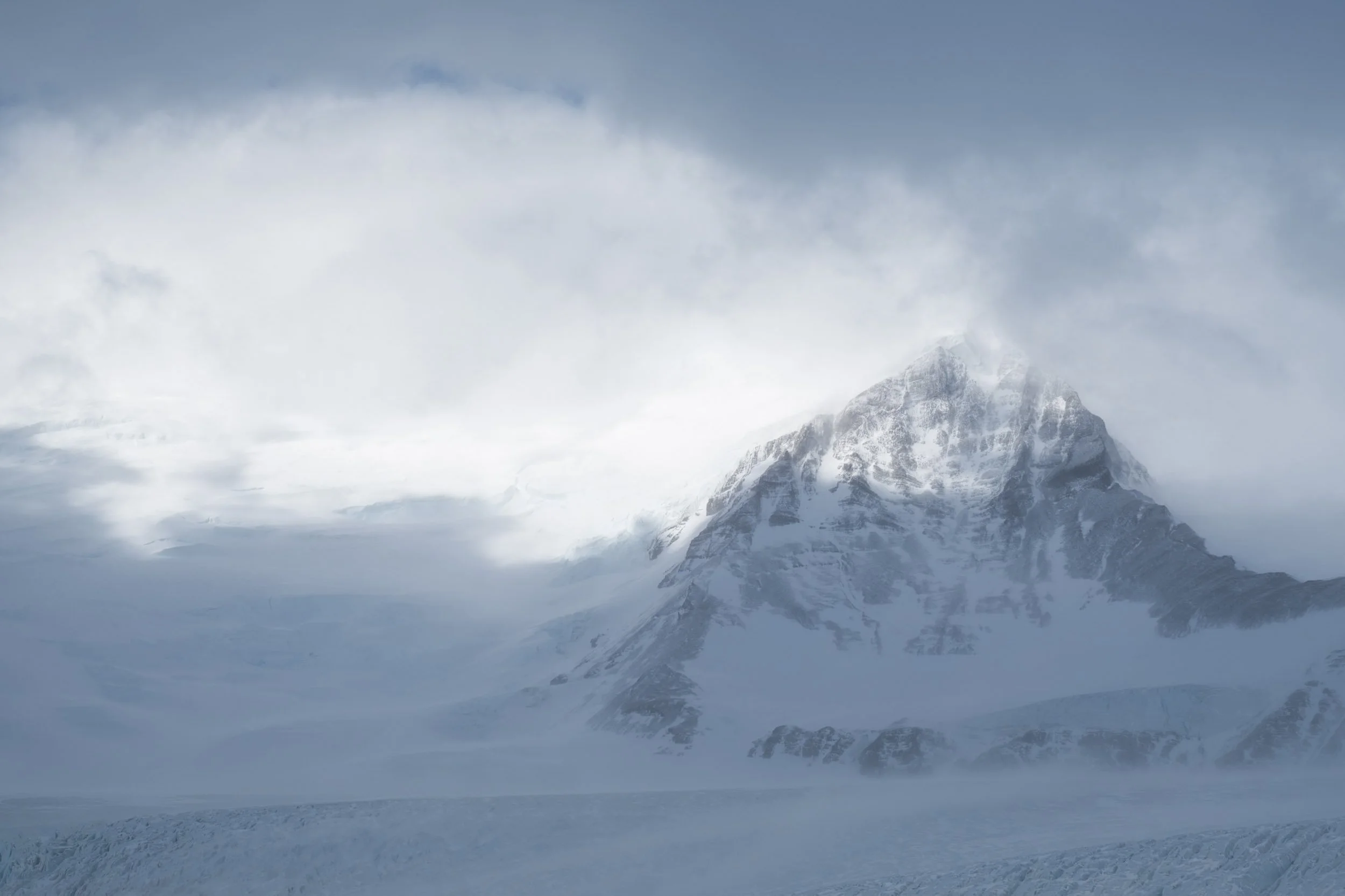
From climbing in the Alps, we've unfortunately become accustomed to retreating glaciers. As a mountaineer, the effects of a changing climate are ever-present. Once majestic seas of ice have been reduced to a mere shadow of themselves. Standing at the glacier lake, we were frightened by what faced us. Not because of the technical nature of the climb, but by the fact that we were staring at a glacier hanging no less than a few hundred vertical meters above us. A truly devastating sight. After having taken in the sight, we turned into problem-solving mode. Stepping straight onto the glacier was clearly out of the question. We needed to find another way up. We knew that the summit is relatively frequently climbed, meaning that a way through the rocks must exist. After a quick scan to the right of the lake, that approach was excluded.
Online, we had read about an alternative approach leading through a gully further to the left of the glacier. After a quick glance, this was also excluded. Clearly that route had been climbed earlier in the season when there was still more snow in the gully. By now the gully had been transformed into a fast-flowing stream. Not a great way up…
This left one possible option: The immediate left side of the lake. From where we were standing, it wasn’t exactly looking like an obvious route, but we decided to get a closer look. As we approached the wall of rock and scree, a route began to form in front of us. The occasional stone man and disturbances in the dirt left by other climbers gave us the confidence that there was a way through.

The next morning, we woke early in order to take advantage of the cold temperatures on the mountain. When crossing snow and ice, it's best to do so before the sun warms it too much. As the temperature rises, the snow turns to slush ice, not dissimilar in texture to the sugary ice drink you give to kids of all ages. Walking in slush ice has two distinct disadvantages. Firstly, it’s physically exhausting, and secondly, the structural integrity is much worse than firm, consolidated snow.
After a quick breakfast, we headed out. We knew from our reconnaissance the day before that we had to make our way around the left side of the lake. Here, we would reach a point where we could start up the scree and rock. With the light of our headlamps, we started making our way up the mountain.
Navigating through the rock and scree progressed well, and as the sun rose, we were treated to an astonishing sunrise. After scrambling for about an hour, we made it to the first snowfield. With the snow cover, we couldn’t easily identify where the border between rock and ice was, so we decided to rope up. When making your way across a glacier, you want to be roped up in the event that you fall through the snow and into a crevasse. Without the rope, a potential crevasse rescue is drastically more challenging.

Unfortunately for us, the sky had been covered with clouds throughout the night, and the temperature never reached below zero degrees Celsius. This resulted in a top layer of very soft snow. The conditions on the glacier were not truly bad, but they were also not great. The soft snow made progress slow and unnecessarily hard. With every step we took, we fell through to your knees. When temperatures drop just below freezing during the night, the top layer of snow turns firm, making it much easier and faster to walk.

About halfway up the mountain, we were faced with two options: Keeping left and crossing a rather steep section of uncovered glacier, or making our way to the right side of the glacier and follow the snow along the ridge. Not fully convinced about crossing the exposed ice, we decided to first give the right side a try. About halfway over the glacier, we got stopped by a significant crevasse. There were clear signs of other climbers having crossed, but the poor snow conditions made it impossible to cross safely. We retraced our steps back to where we had turned off and began making our way up the left side of the glacier.
An important lesson that we have learned again and again on this trip is not to discount a route from a distance. When in doubt, get as close as you can and assess it from there. Crossing over the ice turned out to be just fine. We slowed down a bit to make sure that we could focus on every step, and after a few minutes, we had made it across.

Once we had crossed the ice, the last part of the route continued over the snow-covered glacier. Approaching the summit plateau, an unbelievable view of the Fitz Roy presents itself - A mountain that has been captivating the dreams of climbers for decades.

Finally, the summit! We made it to the summit plateau at 9 o’clock on January the 4th. We knew from our research that it is possible to climb the last few meters of rock from the summit plateau to the true summit. Unfortunately, the rock is of extraordinarily poor quality. It basically breaks of in your hands. Because of this, we decided that the summit plateau was summit enough for us. Happy that we had made it this far, we took a moment to celebrate with a sip of water and an Oreo cookie. After a few photos and a summit message sent home with our Garmin InReach, we began making our way down the mountain.

Going down is almost always faster and much less exhausting. This was luckily no exception. As the sun was now fully up, the temperature was beginning to rise. It was time to get off the ice before the snow got too soft to carry our weight across the crevasses. From what we could see while going up, we had at least 5 larger crevasses to cross before we were off the ice again. Back on solid ground, we cleaned up the rope and took a moment to enjoy the sun before we continued our way down.

Heading down through the final part required focus and attention. As the route is not clearly marked, it's easy to lose track and end up at a dead end. The section is not really technically difficult but somewhat exposed in a few places, making full focus a necessity.

Back at our campsite, we spent the rest of the day relaxing and enjoying the sun. Normally, we walk all the way down after a summit, but with the truly outstanding weather, we decided to stay another night.
After a good night's sleep, we packed up our belongings and continued down the mountain until we once again stood at the trailhead - One very successful adventure richer. The only challenge still standing was getting back to El Chaltén. We knew ahead of time that hitchhiking back to El Chaltén would be challenging early in the morning. At that time of day, most people drive out of town to the trailheads and only return late in the afternoon. After trying our luck for about an hour, a true businessman of a taxi driver stopped and offered us the return trip at a discounted rate. He was anyway going that way with an empty car. We took the deal and made our way back towards El Chaltén.


Between Adventures
What happens when we’re not off the beaten path?
What happens when we’re not off the beaten path? Between every adventure, big or small, we need time to reset for the next one. The amount of downtime needed is highly dependent on the nature of our previous and upcoming adventure. It’s not overly complicated but let me outline our four-phased process. In reality the process is not that strictly segregated. The different steps naturally overlap with each other.

Recovery
This starts the moment we finish an adventure. A warm shower, a solid meal and a long night's sleep are essential for kickstarting the body’s recovery process. The length of this phase is highly dependent on how physically strenuous our previous adventure was but usually we bounce back within 24-48 hours.

Rebuild
Before we can start a new adventure we need to rebuild. We wash clothes, repair rips and tears and fix any broken gear. If needed, we will replace items that are too broken to be repaired. Depending on our location, finding replacements can be a small adventure in itself. We need to ensure that our equipment is fully functional. The success of our next adventure could depend on it.

Prepare
This is the most time and effort consuming phase. We finalise our plan, gather supplies, secure necessary permits and organise needed logistics.
We usually have a rough plan for what we want to do in an area before we arrive. Once we’re there, we need to solidify the plan. This means extensive research - especially if we’re going alpine climbing. We consult guidebooks, countless websites, local information centres and, if possible, local climbers who know the area and have the latest information about the conditions on the mountain. This is valuable information that helps us work out our plan and identify risks that we need to mitigate.
Getting supplies is mostly a question of finding a local supermarket and stocking up on calorie-dense foods like oats, mashed potatoes, textured soy protein and nuts. We normally pack enough food for the time we’ll be away plus a day or two. We try to plan according to the weather forecast but it’s alway good to include a bit of flexibility. We want excellent weather when we climb. It’s more fun and a lot safer that way. With that in mind, we need food enough to get us through a day or two waiting for good weather.
Depending on the adventure, we might need to obtain a permit. In Chile and Argentina it is also common that you have to pay entrance fees for the national parks. This can mostly be done online. In order to leave the beaten path and move higher into the mountains, a special permit is also frequently required. Sometimes simple, sometimes less so.

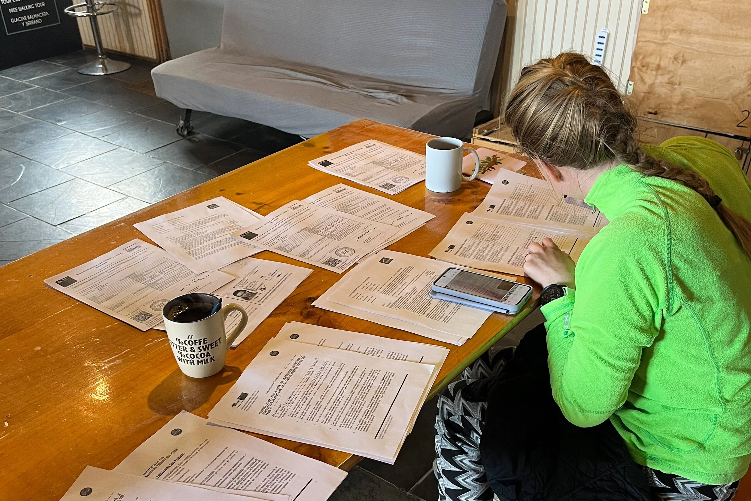
Obtaining a climbing permit can be a complicated affair. The initial task of figuring out what is needed and how to obtain it, is the most time consuming task. Information often has to be pieced together from multiple sources as requirements change frequently. Internet, local contacts and official channels are the way forward. This is how we navigated the permits process for Cerro El Almirante Nieto:
After hours of internet research we had establish that the first step was to apply for a permit from The National Department of State Borders and Boundaries (La Dirección Nacional de Fronteras y Límites del Estado - DIFROL) which is an agency under the Chilean Ministry of Foreign Affairs. This requirement only applies to foreign climbers. Once you figure out where to apply, the process is pretty straightforward. An online form with questions about who, when, what and how you wish to climb. The form has to be submitted at least 20 days in advance to allow coordination between government agencies. Depending on the nature of your climb they might want to take special precautions in case of an emergency. In our case it took less than 24 hours before it was processed and approved.
With the DIFROL-permit secured, we went to the national park information centre for some clarification. We had heard different things from different people and thought it best to go directly to the source. Here we got confirmation that we indeed need the DIFROL-permit plus a separate national park permit. This permit can only be issued by the national park superintendent. The big boss-signature I told about in the El Almirante Nieto-post. Additionally we were told that we would need three copies of both permits plus three copies of our passports. One set of permits for the administration office, one for the ranger station and one for ourselves. With all of this sorted it was just a matter of finding a print shop where we could get it all printed. With that out of the way, we had our permits ready.

Wait
If you’re lucky you can skip this phase entirely and get straight into your adventure but if the weather is not on your side, you might have to wait around until it clears up. Patagonia’s weather is notoriously unstable and the forecast changes almost as frequently as you update your preferred weather app. For the climb of El Almirante Nieto we needed a weather window of at least three days with no rain and at least 12 hours in the middle with no or very little wind. According to our plan, this should be enough time to make an attempt at summiting El Almirante Nieto. Because of a weather front circling around in the Pacific Ocean along the coast of Chile we ended up waiting more than a week before our weather window presented itself. In those moments you have to do your best not to get frustrated and end up with cabin fever. Waiting on weather windows is an integrated part of all mountain sports. Read a book, photograph the local wildlife, do the finances, play cards, plan ahead, go for a run, bake a cake. There are many options. The goal is to make the waiting time enjoyable. The earlier you accept that you can’t control the weather, the better.

If you've recovered, rebuilt and prepared effectively, you’ll be able to move quickly when a weather window presents itself. It’s GO TIME!

El Almirante Nieto - Pushing boundaries
Leaving the comfort zone!
To develop, you need to leave your comfort zone but pushing too far can be overwhelming and counterproductive. The magic happens at the edge of your comfort zone. This is where growth happens. But when you undertake something at the edge, you sometimes have to acknowledge your limits and call it a day.

After waiting over a week for good weather it was finally time to return to Torres del Paine. This time, armed with climbing gear and stacks of papers. Our objective: El Almirante Nieto, a stunning 2640-meter peak. Our first stop was the national parks administrative office.
We needed to collect a crucial signature. The signature of big boss as he was described to us. Big boss was the final obstacle standing between us and our final climbing permit. Ahead of time we had secured the first of two permits via the Ministry of Foreign Affairs (a requirement for foreign climbers). Once you’ve figured out the process, it’s pretty straightforward. More about that another time.
We had heard horror stories about getting the signature of Big Boss, whose official title is Superintendent. The head of the park rangers in Torres del Paine. Online we had read about a process filled with critical questions and skepticism. Local climbers had prepared us for rangers wanting to check your climbing equipment to make sure that you have everything you’ll need. Most annoyingly, this check was supposedly carried out by rangers without any climbing experience. Not all climbs are the same, so gear requirements vary greatly from climb to climb. We bring the gear that we need for a safe climb. Nothing more, and most certainly nothing less.
We had printed all the necessary forms ahead of time and filled them in to the extent possible, hoping to make a good first impression. At the office we were asked to take place and wait outside an office. A park ranger went in and came back out a few seconds later. “He will be with you in a minute”. Fifteen minutes later, the door flew open and a ranger with big boss attitude emerged. From the look on his face it was clear that he had forgotten all about us. He was clearly too busy to deal with yet another pair of climbers. He looked at us, glanced at our backpacks and asked if we had brought the forms. We smiled and handed them over. He quickly scanned through the pages and said “alright”, signed the last page and stamped the park's official seal at the bottom. Just like that, we had our permit!

With the paperwork sorted, we set off to our base camp. In Torres del Paine National Park there are strict rules about how and where you can camp but with a climbing permit those rules are significantly less restrictive. You’re basically allowed to camp wherever it’s required to carry out your climb. During our preparation we had identified two places where we would sleep. A base camp and a high camp. The ranger station at Los Torres would serve as our base camp. By climbers, this is a frequently used base camp. It offers basic amenities like a toilet and running water. A flat-ish looking spot on the map just below the start of our route would be our high camp. Getting to base camp was a straightforward hike. When we walked the O-Circuit a few weeks earlier, we also walked this path so we knew exactly what to expect. When we got to the ranger station we introduced ourselves and handed over a copy of the climbing permit to the rangers on duty. The station was staffed by two young rangers who were clearly having a great time celebrating Christmas in the mountains. Throughout the time we spent at the station, they were either cooking or sitting in the sun enjoying their deliciously looking creations.

On the morning of the second day the winds were strong and with only a few hours of hiking to our high camp, we decided to wait it out a bit. According to the weather forecast the winds should die down around lunchtime. We spent the morning drinking coffee and chatting with the rangers. After lunch we headed for high camp. The first part of the journey follows the path to the Torres viewpoint. Just before you reach the viewpoint you turn off the trail and on to the moraine.

After about an hour and a half navigating through the moraine we had made it to our high camp. Luckily we weren’t the only ones who had ever thought of sleep here. Along with a small but surprisingly straight patch of dirt was a tiny stone wall, built to offer protection against the wind. After a bit of manoeuvring and some digging we managed to pitch our tent. We knew from the forecast that the strong winds would stay until around midnight so we decided expand on the stone wall. Hard work but worthwhile.

The alarm went off at 03:45, giving us forty five minutes to get ready for a 04:30 departure. Getting ready means having a quick bite to eat, getting dressed, gearing up and doing a final check to make sure that we have everything we need. With a slight delay, we left camp at 04:45.

The climb can be divided into three sections. First you ascend a gully, then navigate a rock section and finally you traverse the ridge to the summit. At least, that’s the plan.
The way up the gully is a climb through a mix of snow and scree fields. Not technically challenging but physically exhausting. The gully has an ascent of about 600 metres in less than two kilometres, making it a rather steep affair. Our guidebooks described the gully as “much longer than it looks”. Truer words have seldom been spoken…

After about four hours we made it to the top of the gully. Turning right, the second section of the journey begins. This section is referred to as the rock pass. It’s a fifty meter piece of smooth granite. From a climbing technical perspective, it’s pretty straightforward (probably a UIAA grade III). Nothing too challenging and comfortably within the skill set of both Britt and I. The challenging part is keeping your heads cool while climbing. Even though the climbing is not technically challenging, the exposure is next level. To your left is a few hundred meters of nothingness and to your right is the gully which we just came up through. Climbing this section was gently nudging us towards the edges of our comfort zones.

From the top of the rock section, the third and final section of the climb starts. This part traverses the ridge towards the summit. The climb is a mix of scrambling through rock and navigating the occasional snow field. The technical nature and the level of exposure varies greatly on this section of the climb. In some places it’s walking over rocky terrain. In others, it’s crossing steep snow fields while looking straight into the abyss. Talk about pushing the boundaries of the comfort zone.
We progressed well until we reached a particularly exposed section on the ridge. At this point you traverse a snow field off to the side of the ridge. The drop-off is very real. Crossing this section requires excellent conditions. We knew ahead of time that the wind would pick up in the afternoon making crossing this section more challenging. Unfortunately for us the winds came earlier than expected. After evaluating our options and looking at the time, we decided that continuing up would be too risky. Going up is only half the work, getting back down also takes time.

Turning around is never an easy decision. Especially after having put in a lot of time and effort. In that moment you need to check your ego and put your pride aside. Focus solely on what’s in front of you. We climb to have fun, to challenge ourselves and to experience nature in its purest form. For us, safety must be above anything else. If we don’t trust it, we turn around. That’s what we decided to do here.
After enjoying the scenery, we started on our way back to high camp. We descended with our heads held high. It had been a great day at the edge of our comfort zone. We had fun, we challenged ourselves and we got a chance to enjoy some of the most spectacular landscapes and views that Torres del Paine has to offer. A perfect day.

Returning back to the tent 11 hours later then we had started, we had some food and a quick nap before continuing back down to the ranger station for another 2,5 hours where we spent the night before heading out of the park the next morning. Although we didn’t summit El Almirante Nieto, our adventure was a great success. Perhaps we’ll try again someday…

Torres del Paine - The O-Circuit
We walked around a mountain!
After a few days of rest and some preparation, we were ready to set off for the O-Circuit around Torres del Paine National Park. Most visitors visit the park on day tours or hike a section of the O-Circuit called the W-Circuit. The routes are named after the shapes they form on the map: an “O” and a “W”.

The route is generally speaking easy and poses no technical challenges. The pathfinding is also incredibly straightforward. During the entirety of the circuit you have to choose between paths a handful of times. All intersections are clearly marked and you will have to try hard if you want to get lost. From the moment you enter the park it’s apparent that the park is structured to handle a high volume of visitors. Many of whom have limited outdoor experience.

What the route lacks in technical challenges, it more than makes up for with breathtaking scenery. It is no wonder that this is one of the most sought-after hikes on the continent. Astonishing lakes, spectacular mountains and glaciers as you will only see them in a few places on earth. We were incredibly lucky with the weather - six days of near-perfect conditions. Considering Patagonia’s unpredictable weather, we had more luck than we could have dreamt of.

The first part of the route, from the park entrance to Grey, offers minimal flexibility in where to camp. After Grey you have a bit more flexibility and the choice between a few variations. Most hikers complete the circuit in about 8 days, we did it in 6. Mostly because we were too late with booking the campsites and therefore had to skip a few because they had no space left. This made for some long days at the end but it added to the adventure. This was our itinerary:
Day 1 - From the park entrance to Serón - 14,6 km (361/329 m ascent/descent)
Day 2 - From Serón to Dickson - 19,5 km (664/626 m ascent/descent)
Day 3 - From Dickson to Los Perros - 14,7 km (567/214 m ascent/descent)
Day 4 - From Los Perros to Grey - 18,1 km (1068/1560 m ascent/descent)
Day 5 - From Grey, via Valle Frances to Los Cuernos - 29,4 km (1237/1229 m ascent/descent)
Day 6 - From Los Cuernos, via Base Las Torres to the park entrance - 29,1 km (1663/1628 m ascent/descent)

Every campsite has some form of a common area where people can cook and eat. At night, the main topic of conversation was food choices: Mashed potato powder, cup noodles or freeze-dried meals. Forget politics: No talk about elections or wars raging on other continents. People talk with enthusiasm about the two fresh carrots that they brought for the first night's dinner and with regret about the six apples intended for breakfast in the coming days. Now they’re probably all gonna end up as snacks tomorrow in an attempt to bring down the overall weight of the backpack.

Since you don’t have much choice in where to sleep early on, you end up hiking with the same group for a few days. After a day or so you have familiarised yourself with all the faces and had a chance to talk with some of them. Some people are fast while others take their time and enjoy an afternoon nap in the shadow of a tree. You often end up leapfrogging each other on the trail. This time, we ended up hiking with a Danish couple for a few days. A doctor and a restaurant manager. A lovely couple with great stories. Conversation helps against the pain. When you keep your mind occupied, you forget the physical exertion. If you walk in silence, the battle becomes more mental than physical.
By day three, you can tell who is a seasoned hiker. The way people move around camp tells a crystal clear story. Sore muscles, aching joints and for the unlucky, a blister or two. All part of the experience.

As the days progress, a special bond begins to form between the people hiking the O-Circuit. A bond forged through the shared experience of the adversity endured. A bond not dissimilar to the one experienced in military units. The strong help the weak and the cheerful lifts the mood in dark moments. We are in this together. When the O-Circuit meets the W, the crowds can get overwhelming. There’s too many people for you to relate to them all. Once in a while you’ll pass by a fellow O-trekker and share an acknowledging nod we’re the real ones.

Most campsites have a “free” box where hikers can leave unwanted items. You’ll often find half-empty gas canisters. With a bit of luck you might also find some extra food. To keep the weight of our backpacks as low as possible, we had planned our food supply quite tightly so the joy was very real when we on day five found a box containing more than half a kilo of plain white rice. The additional calories were a pleasant surprise. And to make it even better, in another box we found a pack of delicious cashew and date snacks. Why anyone would abandon such a treat is a mystery, but we weren’t complaining.


For anyone embarking on this kind of an adventure, here’s a few tips that help make life a bit more enjoyable:
Pack calorie-dense foods. You will burn more calories than you think. Skip the carrots and apples. Priorities calories over vitamins.
Stay hydrated! Dehydration is a real risk. It happens more often than you think.
Know how to pitch your tent - also when you’re tired and it’s dark.
Also, know how to use your gas burner. It’s not cool being the one who has to look at the step-by-step guide; how to use my burner hanging in the common room.
When packing your bag: If you doubt whether to bring it, then it’s most likely not essential. A moka pot is not essential.
And finally, do your research. Understand the route and its challenges - and be honest with yourself. You’re not only endangering yourself but also the people around you if you’re not ready pfor the adventure you’re about to embark on.
Free bonus tip: Don’t forget to have fun. And if it’s not fun in the moment, it will probably turn into a great story in a few days.

Puerto Natales - Getting the most out of waiting
One day adventures counts as well!
Arriving in Puerto Natales we had four full days to spend before starting the O-Circuit on the 6th of December. The O-Circuit is the only thing on this month-long adventure that we have booked in advance. There’s limited capacity on the route so the spots fill up months in advance. Waiting around isn’t really our thing so after a day and a half at a nice campsite in Puerto Natales we decided that it was time to leave the city. At least for one night.

Tuesday at noon, we hopped on a small local bus to Villa Serrano. The village consists of a few fancy hotels and a handful of horse and sheep ranches. From Villa Serrano there should be a footpath leading up into the mountains and to the side of a small lake. It looked outstanding on the satellite images, and the reality didn’t disappoint. We had the most spectacular view of Torres del Paine National Park. A view filled to the brim with beautiful mountains. The small lake was incredibly peaceful and the water was crystal clear - a stark contrast to last week's water quality.
Finding a suitable spot for our tent proved tricky. Flat ground is a scarce commodity on a mountainside, and this time was no exception. After a half-hour search, we found a semi-flat patch of grass - just about level enough for one night. Sleeping on a slope means frequent readjustments of sleeping bags and mats throughout the night, but that's part of the adventure.

What never ceases to amaze me when we move from the city to camping in the wild is the difference in noise. You only truly appreciate the cacophony of city life when you experience true silence. No accelerating cars, no impatient drivers honking, no dogs barking, no music playing in the distance. Just silence.

Walking back down, we enjoyed a nearly uninterrupted view of Torres del Paine: the incredible Grey Glacier, the spectacular Cerro Paine Grande and the three iconic towers which are at the centre of every postcard and adventure photo from this area.

To top it off, a majestic condor soared past, just a few meters away. Circling the mountain side, enjoying the upwards streaming air produced by the morning sun hitting the ground below us. What a spectacular view - a flying condor against the backdrop of Torres del Paine. They couldn’t fake it in a tv-commercial. Pure magic!


Chilling in Bahia el Aguila
Time to slow down and enjoy the view!
After two days of rest and relaxation in Punta Arenas, it was time for a new small adventure. This time a little more laid back than last time. From two fellow travellers we had heard about a beautiful hike along the coast just south of Punta Arenas. In its entirety the hike should be quite the gruelling affair containing multiple deep river crossings and hours of hiking in loose stones and sand on the beach. Not really what we had in mind for this mini-adventure. With a big hike coming up next week, there's a good reason not to overdo it this time around. We decided to split the difference and do a portion of the hike.

From Punta Arenas we took a public bus to San Juan about an hour's drive south of the city. From here we walked along the coastline passing by the San Isidro Lighthouse and ending up in the Eagle Bay (Bahia el Aguila) where we set up camp. While walking the coast, we spotted not only sei whales but also sea lions and seals. In total we hiked about 18 kilometres. For a day which was intended to be easy, it was still pretty hard. Our plan was to find a good camping spot which we could use for two nights so that we could spend the second day doing a bit of joy hiking along the beach.

After looking around a bit for the perfect spot in the bay we found a small clearing which would do the trick. Clearly other people had been camping there before us. The only disadvantage was a less than optimal water supply. A small stream with relatively slow running yellowish water… After a really bad case of stomach issues a few years ago in Scotland, we have gotten more careful when choosing our water sources. But really, it was this or hiking an additional 5 kilometres before we would get to the next bigger river. And there was no guarantee that it would be any better. We decided to stay put but doubled up on our water safety measures by first cleaning the water with chlorine and then boiling it. That should kill most unpleasantries.
As we finished dinner, a speedboat broke the silence, heading straight for our spot on the coastline. From a distance it was difficult to see who or what was approaching. It turned out to be a local tour guide with a small group of tourists. One of the guests needed a toilet break and the beach in front of us is the only safe landing spot in the bay, away from the sharp rocks along the coastline. The guide apologised for breaking our peace and quiet. To make up for the disruption she offered cookies and freshwater. We happily accepted.

We chatted briefly with her and the two other crew members while their guests were enjoying the beach. She told us about a whale that had washed ashore last year; you could still find pieces of its teeth along the coast. A few minutes later, she returned with one.

Quite impressive! She also told us that the orange fungi growing on trees throughout southern Chile and Argentina are edible - tasteless but nutritious. As a parting gift she assured us that the water from the steam was safe to drink though it does have a very high mineral content turning it yellow. And just like that, peace returned to our little slice of paradise.

Other hikers had warned us about the foxes lurking in the forest and along the coastline; any unattended food or garbage is an easy target for these opportunistic creatures. I really wanted a photo of the fox so I was secretly hoping that it would show up. As the sun set, a fox appeared. After lurking at the edge of the forest, it dared sneaking a bit closer, hoping to find any unattended treats. As a precaution, we had hung our food bag high in a tree - well outside the reach of the fox’s tiny paws. After having sniffed around for a few minutes the fox retreated back into the forest. Disappointed by the inaccessible food and the fact that two vegans had set up camp on its beach. No sausages or steaks to steal at night, only dry oats and potato flakes. Disappointed, it didn’t return after that.

The next day, we packed a light bag with essentials: warm clothes, camera gear and empty water bottles. Our plan had all along been to do an easy hike that day so walking the 5 kilometre to the next river in search of better water seemed like a suitable goal. The hike along the coastline was impressive, with spectacular landscapes. The water quality at the next river was better - not perfect but definitely a significant improvement. We filled our bottles and headed back to camp. We enjoyed a well-deserved dinner while watching the whales pass by our bay.

On our third day we planned to walk back towards our original drop-off point. The bus was scheduled to leave Saturday morning at 9.15, with the next one not for another 12 hours, so we didn’t really feel like missing the morning departure. We found a cute little camp spot by a river about 3,5 kilometres from the bus stop. We didn’t want to camp right next to the bus stop so this seemed like a good compromise. This way we wouldn’t have to get up too early to make the last stretch.
The river teemed with small fishes and the air was full of beautiful birds. While cooking dinner, I looked out over the channel and to my amazement saw a jumping dolphin. I immediately abandoned the stove, grabbed my camera and ran to the coast, hoping to capture a picture of a jumping dolphin. Dolphins, just like whales and other marine wildlife, are notoriously difficult to photograph. You only see them when they’re out of the water and then you’re almost always too late.


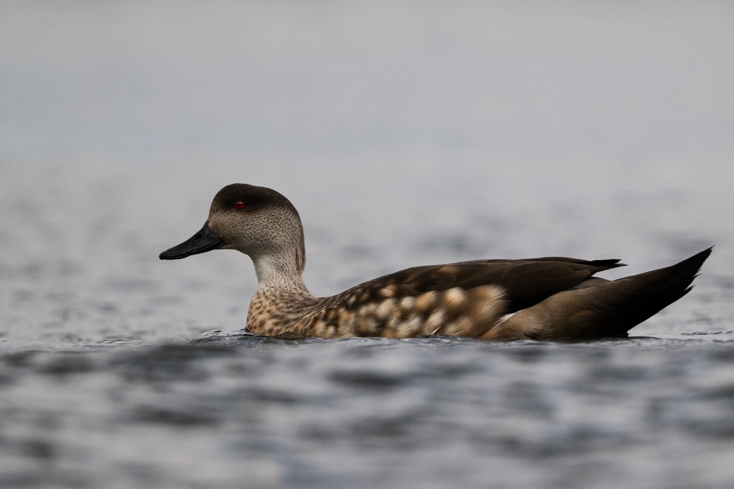


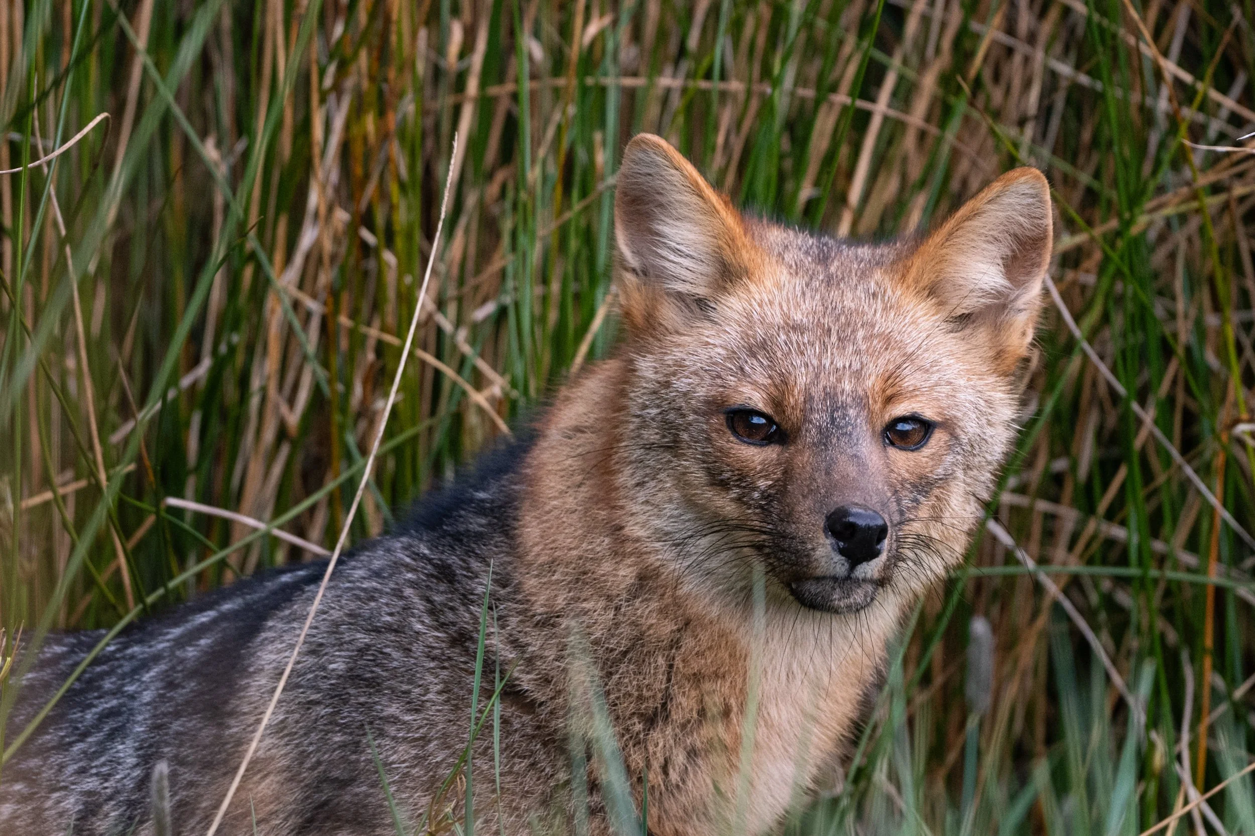


The next morning, as we walked the last few kilometres to the bus, we joked about how Patagonia is the only place where the sun can be burning your face, while it’s raining down your neck. To call the weather temperamental is to put it gently. We made it to the bus with plenty of time to spare.

Magdalena Island and its penguins
Thousands of penguins!
After about two and a half weeks of great adventures in and around Ushuaia we travelled northwest to Punta Arenas in Chile. Even though the line-of-sight distance is only about 250 kilometres the travel time is more than 10 hours. We chose to travel the route by bus and honestly the ride was surprisingly pleasant. Because of bad weather we unfortunately ended up with a delay of about 6 hours. Making the total travel time much longer than anticipated.
Part of the journey from Ushuaia to Punta Arenas is a crossing of the Strait of Magellan with a short ferry ride. The strait is only about 5 kilometres wide at the crossing point and the sailing time is short but because of strong winds the ferry couldn’t sail. The bus drivers were unfazed, telling us to sit back and relax. This was nothing new to them. Worried about missing our hostel check-in, we scrambled to find WiFi allowing us to notify them about the delay. Their answer: “I already assumed so. The winds are strong today. Just relax”. We did our best to follow their advice and relaxed the best we could. Luckily Britt came prepared with the entire latest season of Emily in Paris. With nowhere else to go, I joined in on the dramatic love life of Emily.

The next morning we set off for one of the highlights that I’ve been eagerly looking forward to: Magdalena Island and its thousands of Magellanic penguins. The exact number of penguins on the island varies depending on the source but the number seems to be in the range 40.000-60.000. Unfortunately the number seems to be declining year by year. The cause for the decline also varies depending on who you ask but the answer always seems connected to the effects of a changing climate.

The island is designated as a natural monument and visitors are only allowed as a part of an organised tour. Not our usual style, but sometimes you have to go with the flow. Getting to the island requires a ride through the beautiful Strait of Magellan. There are multiple operators who offer this tour and we went with the local ferry company which uses one of their regular car ferries as a tour ferry in the weekend. The price is lower while sailing time is longer, compared to some of the other operators. We enjoy being on the water, so it was an easy choice. Even before we made it to the island it was an epic wildlife experience. From the deck of the ferry we saw a plethora of beautiful birds, the top fins of Sei whales, a jumping seal and dolphins playing in the waves in front of the boat.

As we landed on the beach of the island, two crew members had been tasked with the important job of nudging the curious penguins to make way for the ferry’s landing ramp. On this island, the penguins rule. If they decide to sit tight, we have to wait. After a brief wait the penguins retreated a bit, making enough room for the crew to lower the ramp. The first thing that strikes you when you land on the island is the cuteness factor of these wonderful creatures. No wonder that rule number one on the island is DO NOT TOUCH THE PENGUINS.

As a passionate photographer this is a true paradise. You rarely get to be this close to your subject while still being able to move around. As always when I’m photographing wildlife, I do my best to get to eye-level of the animal. To me, it creates the most natural and visually pleasing images. When your subject is less than half a meter tall that means lying on the ground. After a brief moment of lying on the ground photographing, one of the guides came up to me politely asking me not to lay on the ground. The penguins have lice so it’s better not to be lying down. Alright, fair enough. I’d anyway prefer skipping a case of penguin lice.

I could have spent countless hours on the island watching and photographing the penguins but unfortunately you only have one. These measures are necessary to manage the effects of the many visitors. A bit of a shame but understandable. Additionally, you also have to move along a predefined path around the island. Throughout the walk we were accompanied by three very talkative guides. The last guide had the almost impossible task of keeping the eager photographers moving. A more or less constant “please don’t forget we have only one hour to complete the circle” could be heard. Mostly directed at me or one of a few other avid photographers on the tour. For the record, we made it back to the boat fully within the designated hour.


Even though we only had one hour on the island, it was a truly incredible experience which I will think back on in the years to come. Being able to walk amongst these wonderful animals is a unique experience which I wish anyone travelling this area would allow themselves to enjoy.

True wilderness
Into the wild!
This time we really got ourselves into an adventure. A fellow traveler had left a book in the common area of our campsite in Ushuaia with the story of two locals who spent weekends and holidays over the past many years exploring a previously unknown valley. The book, written in Spanish just to make it real fun, outlined the possibility of making a circle around a chain of mountains by connecting three valleys via two passes. This sounded like the perfect recipe for a true adventure.
We headed out Sunday just before lunchtime. The plan was to hike a short section of the route in the afternoon before setting up camp for the night. The first section of the route was very well marked and follows a clear path towards a more frequently visited mountain lake. As you pass the exit to the waterfall and continue deeper into the valley the game steps up a level or two. From here you’re either stomping through muddy peat or crawling through thick forest.
The marks indicating that you’re on the right track can be anything from a small reflective sticker on a tree to three branches on the forest floor giving you a general direction of travel. The further you wander into the valley, the fewer markers you get. In some places you’re happy just to see an old boot imprint in the mud ahead of you. At least someone else walked here once before.

In one place a bridge had been made in order for you to cross a river. Impressively it’s mainly built from materials found in the forest. In most places though, a few half-rotten pieces of wood will have to do for an improvised bridge. Mostly, that works out just fine as long as you’re wearing waterproof boots. While crossing one of these improvised bridges I used my hiking pole to try and keep my balance but in a misjudgment of the stability of the ground next to me the pole disappeared into the nothingness of the peat and a split second later I followed. Waist-deep in peat. Not an optimal situation to be honest. After a few moments of thinking this must be the least glorious way to die we started working on an escape plan. Backpacks off, camera off, hiking pole out of the peat. While Britt worked on finding safe ground from where she could help, I felt the chilling water soaking my trousers and filling my boots. Getting out of peat can be a truly tricky maneuver especially if you’re on your own. Getting out while still wearing your boots? An art form in itself. Luckily Britt was there to the rescue. After a few minutes of fighting against the peat I was free. Free but muddy and wet, and in this climate that meant wet boots for days. As I said, not an optimal situation. But well… Adventure.

Wednesday was the defining day for our week-long adventure. Whether we managed to reach the first pass around lunchtime would determine if we would be able to make the full circle around the mountains or if we would have to retreat the same way as we had walked in. After a lot of hard work we reached the pass at around 13.00. One last check with each other. Do we think it looks doable from here? Once we committed and went over the pass it meant that we had to finalise the circuit in about 48 hours. Otherwise, we’d be cutting it close with our food supply and our already planned onward journey. Luckily the view from the pass gave us the confidence that it would be doable. It’s a go!

As soon as we crossed the pass, the descent back to the valley floor began. After an additional four hours of descent through a burned-out forest, we reached the valley on the other side. Now it was just a question of finding a suitable spot for our tent. Pitch the tent, make the beds and prepare the culinary masterpiece consisting of polenta, soya chunks and vegetable broth. The key to this marvel of a dish is its simplicity… Or our hunger. Who knows… It was a very unique experience sleeping in a burned out forest. There’s something strangely eerie about the whistling sound of wind blowing through leafless trees.

After a somewhat windy night we set off for the last pass early in the morning. From where we slept it looked quite straightforward. As we approached the pass it did indeed turn out to be an easy scramble at a relatively pleasant incline. Just huffing and puffing until the top. At the top of the pass we were faced with a slightly more challenging descent. The descent didn’t require the use of climbing gear or any actual climbing but the route passed through multiple snowfields and down a few short sections of rock which required the use of both hands and feet to navigate safely. After reaching the valley floor on the other side it should be a pretty simple walk out back to the trailhead.

On the way out we spent one last night in the most idyllic little clearing in the forest next to the river and a huge beaver dam. Throughout the whole trip we have been passing by beaver dam after beaver dam. Impressively large and complicated marvels of engineering built by someone the size of a small dog! Some dams consist of one pool while others are built like a series of interconnected pools.

I had been hoping to make a photo of one of the beavers all week but so far without any success. As this was the last chance, at least for now, I was determined to wait by the dam for as long as needed or until it was too dark to photograph. The tricky thing about photographing beavers is that they leave their houses only just before it gets dark. I was sitting on the brink of the pool waiting for a beaver to hopefully show itself when I heard a massive splash of water. In the other end of the pool, some 150 meters away, a beaver presented itself. With its characteristic whip with the tail, sending water high into the air, the beaver dove under the surface looking for fish. After a few minutes the beaver decided to try its luck in the end of the pool where I was sitting. What a show!

After having made a handful of photos and the beaver had started to move back towards the other end of the pool, I ran back to the tent to get Britt and tell her to come join me for the spectacle. To get to the beaver dam you had to cross a smaller river. Not huge, but big enough though that it needed to be done by taking your shoes off and walking through the knee deep water. In my excitement to share the news with Britt I neglected to put my shoes back on on the other side of the river and just ran barefoot to the tent. Unfortunately stepping on a particularly nasty little bush with tiny thorns in the process. The outcome was a smaller medical procedure performed in the tent trying to get the thorns out of my feet.
Friday morning we set off for the final stretch of our circle and back towards civilisation. At the trailhead we managed to get a ride from two lovely Filipinos living in the US. During the ride back to Ushuaia we exchanged stories about our experiences in and around Ushuaia. It’s always fascinating to hear other people’s perspectives on the same place.


After a good night's sleep we jumped on a bus Saturday morning towards Punta Arenas in Chile. On our way out of Ushuaia we passed the trailhead for our adventure. The valley looked calm and peaceful, not the battlefield it had been in our struggle against the muddy peat. After all, I guess we are just guests in the true wilderness.

Heading south
The most southern city on earth!
To conclude our time in Buenos Aires we dedicated a full day to the classical arts. During the day we visited The National Museum of Fine Arts. The museum houses a beautiful collection of classical and contemporary art. Entry was for free so the value for money was surely an A++. In the evening we enjoyed a classical concert performed by one of Argentina's youth orchestras. An enjoyable evening and with free admission, it was a steal! Buenos Aires pleasantly surprised us. We’re not really city people but we enjoyed our time there. The people are friendly, the food is good (though not cheap) and the streets feel safe even at night. We especially loved the city’s many well-maintained parks, clearly enjoyed by the locals.
After yet another broken night, we made it to the most southern city on earth: Ushuaia. As a welcoming gift, or a warning not to forget where you are, it was raining when we arrived. After a few hours of soul draining rain, the sun finally pushed through the clouds and shed some sunlight on the place. It’s impressive what a bit of sun can do to positively change your perception of the surroundings. It’s difficult to describe the end-of-the-world feeling but it’s for sure a thing. It has this self-reliant, last frontier feeling. There is not much further south from here apart from a few small settlements of which Puerto Williams with its less than 2000 inhabitants by far is the largest.
We pitched our tent on a small campsite run by a local family on the outskirts of the city. The site can best be described as a garden with space for tents. There is a nice common area for cooking, hanging out and sheltering from the ever-changing weather. The sanitary building is heated to a degree only outperformed by the Sahara desert at lunch time. All in all, a good place to use as our base.
In our first few days here in Ushuaia we walked some shorter day hikes. Ushuaia lies at the foot of the mountains so there’re plenty to explore. The campsite is located along a gravel road leading to the trailhead for multiple hikes so it was obvious to start walking from the campsite. We hadn’t, however, anticipated the amount of dogs roaming the streets in this part of town. Some are pets while others are strays. Some seem friendly while others are less keen on hikers passing through. The hike itself was beautiful but muddy which led to funny moments with other tourists trying to keep their white sneakers somewhat white. Heading back down from the trailhead to the campsite we hitched a ride with two local trail runners. Half-laughingly they told us that this piece of road is the worst in the town when it comes to street dogs… Would have been nice to know in advance, I guess… Adventure, right?

The past few days we spent inside Tierra del Fuego National Park. Apart from the cruise ships leaving for Antarctica, this park is the main reason that people travel this far south. Most people experience the park on an organised day trip but if you take your time and bring your tent, you’re in for a special kind of a treat. The park is beautiful in all senses of the word and at night it’s as quiet as can be. The only sound breaking the silence is the noise made by the wings of the bats flying overhead. During the day you’re treated to astonishing landscapes and beautiful wildlife. While washing your dishes in the nearby river you’ll be accompanied by curious semi-wild horses who roam the park freely. We had a truly amazing time in the park.

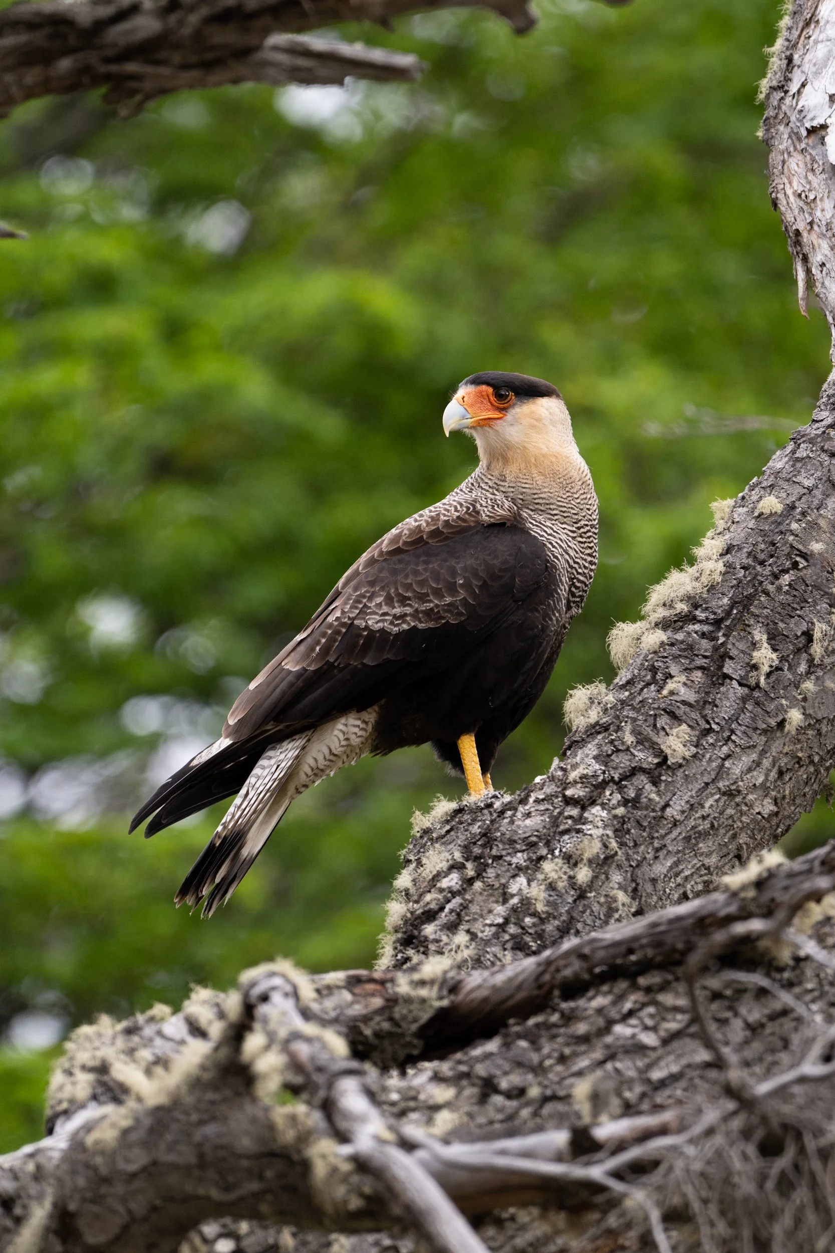


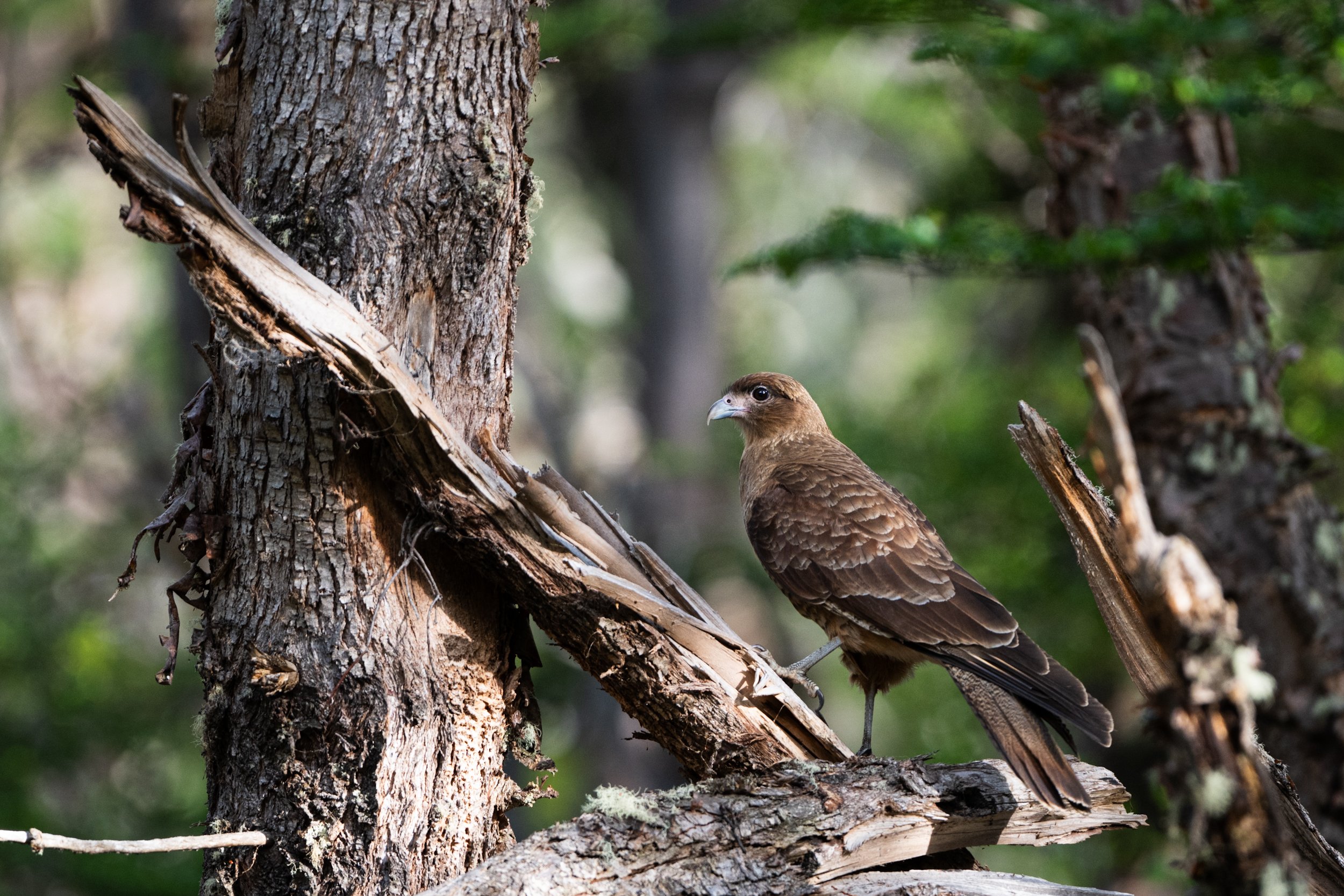

Heading out of the park and back to Ushuaia, we hitched a ride with two Argentinians. A boy and his (grand)father visiting the park. Eventhough we don’t speak Spanish you can get quite far with Google Translate and lots of hand gestures. They were visiting from Tolhuin, the next bigger city up north along highway 3. They were happy to take us to Ushuaia and drop us off at the supermarket. Ideal as a resupply was needed after the days off-grid. The boy told that he was an avid coin collector and asked very politely if we might have any small coins from the Netherlands. “Nothing big, only a small one”. Luckily Britt had been carrying around a 10 eurocent coin in her pocket since we left Europe. In exchange we got a 20 Argentinian pesos bill as a souvenir. With the rampant inflation in Argentina, it’s euro equivalent value is 0,2 cents. It’s for sure going up on the wall when we get home.

New York and Buenos Aires
The adventure is on!
The adventure is on! After a solid 30 hours of traveling we made it to the other side of the world. The plane to New York JFK was smooth and filled with B-movies. After a quick chat with a cheerful U.S. Customs and Border Protection Officer we made our way into New York. With a layover of about 8 hours we were determined to make the most of it. We grabbed the train from the airport to Penn Station. From here we walked by the Flatiron Building at Madison Square Park, had a quick look at the Chrysler Building and walked past Trump Tower on our way to Central Park. After a quick walk along the edge of the park we had to start our retreat back to Penn Station. On our way back to the station we grabbed a burger which we ate while crossing Times Square. Seemed like the most American thing we could do. After our speedy tour of New York City we hurried back to the airport and prepared ourselves for the last leg of our travel towards Argentina. Some 11 hours of back breaking, leg numbing semi-sleeping. But well, it’s all a part of the experience.
Landing in Argentina and getting through passport control was a straightforward and relatively pleasant experience. We had arranged for a car to pick us up at the airport and bring us to the hotel. After about 10 minutes of driving we ended up in the emergency lane with a flat tire. I told you, the adventure is on! After a wheel change that would make any F1 pit crew jealous, we were back on the road.

After dropping our bags at the hotel we went for a walk around Buenos Aires to get a feeling for the place. The temperature this time of year is very pleasant and lends itself very well to taking a well-deserved break under a tree in one of Buenos Aires' beautiful parks. As the outdoor people we are, we of course found our way to the Buenos Aires Ecological Reserve. An absolutely fantastic place surrounded by the bustling inner city. No wonder that this is a favorite place among the locals. Walking the paths through the reserve we encountered a wide range of beautiful birds and a few reptiles chilling in the sun.
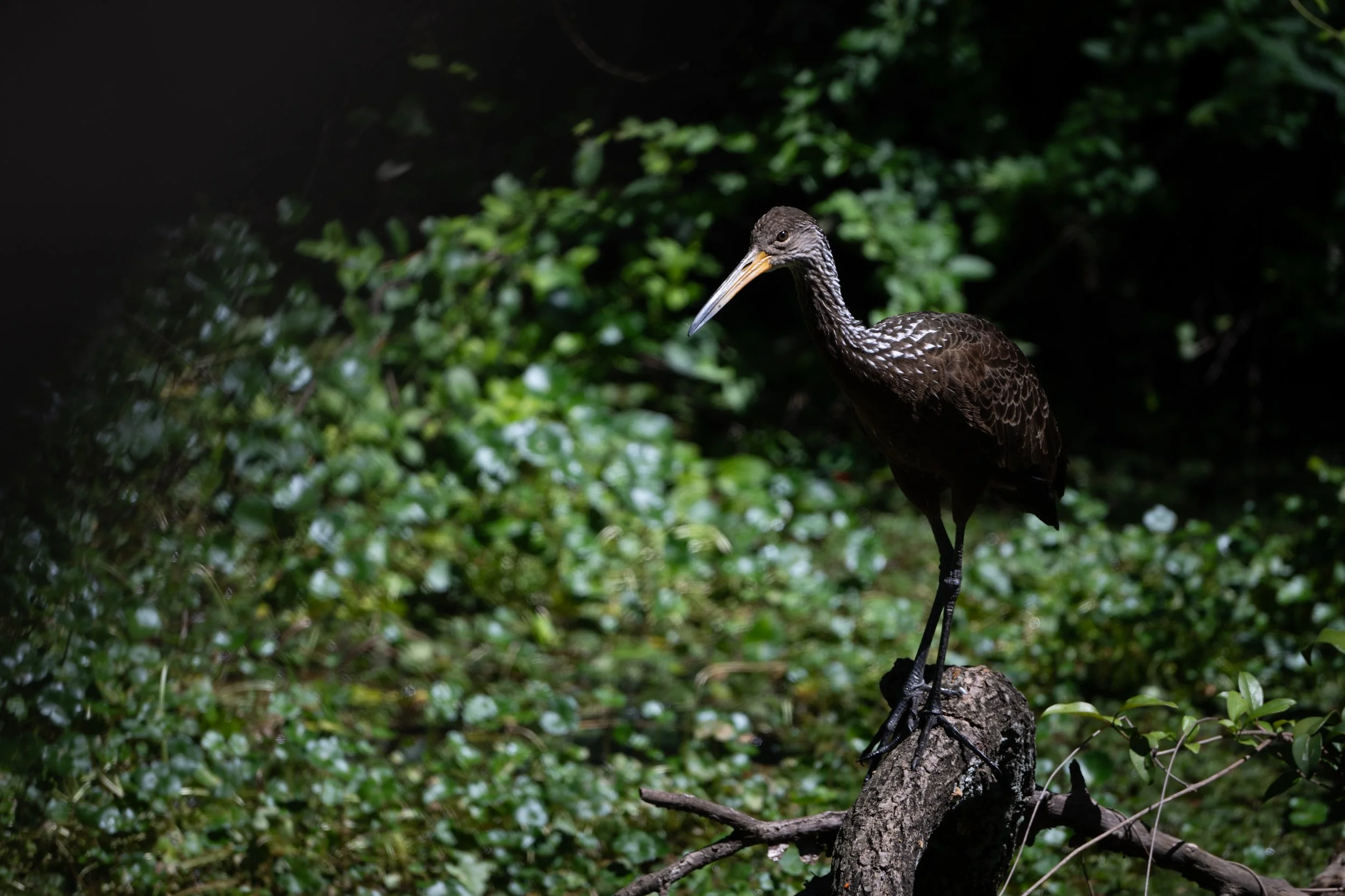


Tomorrow is a new adventure!

Preparing for adventures
Almost ready to go! Adventure awaits!
For now, we're still busy preparing the last few details of our upcoming adventure in South America. Mostly, it's about packing and repacking our backpacks until we find the optimal ratio of weight to equipment. The more equipment we bring, the heavier our backpacks get, but we also don't want to leave anything essential at home. It's all about choices!
During our travels, we'll try to share updates here from time to time. The reality is that the frequency and quality of the updates will depend on the situation on the ground. When we have time (and access to the internet), we'll share our experiences. We can't wait to share all the details and stories in person when we return!
Talk soon!